Warmer temps a relief after round of snowstorms
Mineral Independent | Hagadone News Network | UPDATED 9 years AGO
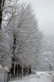
Mineral County residents are breathing a sigh of relief and hope the last storms of the winter season have swept through the county with temperatures predicted to top 50 degrees this week. A welcome relief after western Montana was pounded with several more inches of snow last week. On Thursday, March 9, residents awoke to another six to eight inches of snow, after receiving around four inches last Wednesday.
Lookout Pass ski resort reported 32 inches of new snow over that time period. This was one of the better seasons they have had with 141 inches at the summit and 124 inches at the base as of March 10. It’s also been a longer season where they normally close around April 9, but may extend the season until April 15 this year said the Director of Communication, Paul Cahill.
According to Lucas Zukiewicz, the Natural Resources Conservation Service water supply specialists for Montana, February brought a notable change to the weather patterns that were experienced during the month of January, reported in snowpack data collected by the USDA Natural Resources Conservation Service, Montana.
Record breaking snowfall for the month of February was experienced in northern and southern river basins of the state during the first two weeks of the month. Snow blanketed the Rocky Mountain Front at the beginning of the month, with low elevations and valleys receiving more than 3 feet of snow. Flattop Mountain SNOTEL (snow telemetry) site in Glacier National Park set a new record for February snowfall and received 12.5 inches of snow water during the month, well above the 30 year normal of 5.3 inches for February. Further south, Cooke City received copious amounts of snow, prompting the first ever “Extreme” avalanche warning for the area when Fisher Creek SNOTEL received 10.9 inches of snow water between Jan. 31 and Feb. 11. Statewide, 12 SNOTEL sites set new records for February totals, and six sites were second highest.
As of March 1, the Lower Clark Fork River reservoir storage is averaging 115 percent and is at 77 percent capacity. This is compared to 101 percent this time last year. Also, precipitation on the Clark Fork has a monthly average of 186 percent with a water year average at 131 percent, compared to 132 percent last year.
Zukiewicz said all basins experienced substantial improvements over the month with many now at near to above normal, and most basins are also near to above last year at this time.
“There are some sub-basins that remain below normal for this date due to the late onset of snowpack this year and sub-par November and January snowfall,” Zukiewicz said. “One major basin is still recovering from near record low early season snow; the Smith-Judith-Musselshell will be reliant on spring precipitation to make up ground before spring and summer runoff.”
February typically isn’t one of the “big” snow months for Montana, he said, but this year proved otherwise. As we make the transition into spring, precipitation is favored along and east of the Continental Divide.
“Near normal conditions on this date is great news, but there is still a month to a month and a half before snowpack generally peaks in the mountains of Montana,” Zukiewicz said. “The coming months and their weather patterns will play a critical role in the timing and magnitudes of water in the rivers this coming spring and summer.”
ARTICLES BY MINERAL INDEPENDENT

Homicide suspect to appear in court on April 16
The arraignment for former Thompson Falls resident Danielle Wood, who has been charged with one count of deliberate homicide, has been set for Tuesday, April 16 before District Court Judge Deborah “Kim” Christopher.

Bears seeking food sources ahead of hibernation
Montana is bear country. Black bears and grizzly bears are very active right now as denning season approaches. Bears are actively seeking food sources before winter, and residents are advised to clean up or secure food attractants, such as garbage, dog food, and livestock. Bears are particularly seeking out natural fruits, such as berries, and domestic fruits, such as apples and pears. Residents are advised to pick up any fallen fruit from their property to help prevent attracting a bear.

Rendezvousing with the past
A rugged group of individuals with a thirst for adventure and fortune made their way west after the Lewis and Clark Expedition – after some time in the wilderness they would rendezvous in places like St. Louis to trade fur and goods as well as engage in friendly competition. Stories of daring and close escapes from Indians were swapped around a campfire by people like John Colter, who ran hundreds of miles in nothing but his Birthday suit to get safely back to civilization.


