Less snow expected for 2018-2019
Randy Mann | Hagadone News Network | UPDATED 7 years, 1 month AGO

In this Dec. 2017 photo, Andrea Peters sweeps snow off her car in Coeur d'Alene. (LOREN BENOIT/Press)

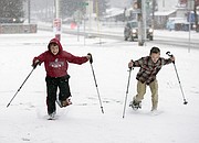
LOREN BENOIT/Press Lakes Middle School sixth-graders Gage Henson, left, and Hudson Howard race in the snow during their outdoor sports class in December 2016. Coeur d’Alene is expected to receive between 40 and 49 inches of snow this season, according to Press meteorologist Randy Mann.

JAKE PARRISH/Press Kyle Jones, left, works with Kale Pfeifeir to remove more than six inches of snow from the roof of a home on Pennsylvania Avenue in Coeur d’Alene, in this photo from Dec. 2015.

(Photo courtesy SCHWEITZER MOUNTAIN RESORT) A skier charges through the powder at Schweitzer Mountain Resort in January. Area ski resorts can expect anywhere between 150 and 300 inches of snow this season.

BRIAN WALKER/Press Snow-blasted trees at the Hayden Area Sewer Board’s land application site along Boekel Road between Rathdrum and Hayden made for a cold, wintery scene in January 2017. Randy Mann expects between 51 to 56 inches of snow for Hayden this season, and as much as 67 inches for Rathdrum.


Every year in mid-autumn, Cliff Harris and I issue our annual city-by-city snowfall predictions for North Idaho and surrounding areas of the Inland Empire.
For the 2017-18 snowfall season, we measured 90.3 inches of snow for the season, a bit above the average snowfall for Coeur d’Alene since 1895 of 69.8 inches.
Last winter season was literally “the tale of three winters” across North Idaho. It’s amazing that we had three periods of relatively heavy snowfalls in a short period of time. Cliff tells me that searching through his records dating back to 1895, there wasn’t a single snowfall season like the last one.
The “first” winter began in early November 2017. From Nov. 2-6, a total of 8.8 inches of snow fell, including a record 3.7 inches on Nov. 5.
Then, our “second” winter arrived about 6 weeks after the big snows in early November. From Dec. 15-31, 32.7 inches of snow was reported at Cliff’s station. To the delight of many, there was plenty of snow for Christmas. When 2017 came to a close on Dec. 31, Coeur d’Alene had seen 41.6 inches.
Conditions turned dry at the beginning of 2018, then “third” winter arrived as big snows fell in mid-February and continued into March taking our final total to just over 90 inches for the season.
When there is a cooler than normal sea-surface temperature event, “La Nina,” in the south-central Pacific Ocean, snowfall totals in the Inland Northwest are often heavier than normal.
During a very chilly and strong La Nina sea-surface temperature pattern in the harsh winter of 2007-08, when there were also very few sunspots, Cliff gauged an all-time record 172.9 inches of snow on Player Drive. The next winter of 2008-09 was the second snowiest on record in Coeur d’Alene with a whopping 145.6 inches.
The two winters of 2007-08 and 2008-09 back-to-back produced an incredible 318.5 inches of snow in town, more than 100 inches greater than the previous two-year total of 217.6 inches combined in 1915-16 and 1916-17.
A record number of building collapses occurred in our region of the country between December of 2007 and January of 2009, when I had to have my roof shoveled off twice!
Then, by extreme contrast, thanks to a warm, wet “El Nino” phenomenon in the waters of the eastern Pacific, our total snowfall of the entire winter of 2009-10 was a mere 18.4 inches, a whopping 51.4 inches below the normal on Player Drive of 69.8 inches. What a difference a year makes, weatherwise and otherwise.
For this winter season, ocean waters are warming up across the Equatorial regions and a new warmer “El Nino” is expected to be declared very soon. Therefore, Cliff and I are predicting snowfall totals to be below normal.
1. The area ski resorts should measure between 150 inches at Mt. Spokane to as much as 300 inches of snow at Lookout Pass along the Idaho/Montana border.
2. Priest Lake: 68 to 73 inches.
3. Spirit Lake: 65 to 70 inches.
4. Twin Lakes: 63 to 68 inches.
5. Rathdrum: 62 to 67 inches.
6. Sandpoint: 61 to 66 inches.
7. Wallace: 60 to 65 inches.
8. Hauser Lake: 58 to 63 inches.
9. Kellogg (town): 57 to 62 inches.
10. Hayden Lake (above 2,400 feet): 55 to 60 inches.
11. Athol/Garwood: 52 to 57 inches.
12. Hayden (town): 51 to 56 inches.
13. NW Coeur d’Alene (Cliff’s station on Player Drive): 49 to 54 inches.
14. Fernan Lake: 47 to 52 inches.
15. Dalton Gardens: 46 to 51 inches.
16. St. Maries: 45 to 50 inches.
17. Kalispell, Mont.: 44 to 49 inches.
18. Hope: 42 to 47 inches.
19. Coeur d’Alene (Downtown near the Cd’A Resort): 40 to 45 inches.
20. Post Falls: 39 to 44 inches.
21. Plummer: 36 to 41 inches.
22. Harrison: 35 to 40 inches.
23. Missoula, Mont.: 34 to 39 inches.
24. Spokane (South Hill): 32 to 37 inches.
25. Bayview: 31 to 36 inches.
26. Spokane Valley: 30 to 35 inches.
27. Spokane International Airport: 29 to 34 inches.
As usual, we reserve the right to adjust these seasonal snowfall predictions after we see what happens with the current warm and wet ‘El Nino’ by mid- December. Stay tuned.
In terms of our local weather, the strong ridge of high pressure that has brought us the dry weather is expected to weaken to start allowing some moisture to move into our region later this week with more rain in the lower elevations next week as well. The long-range computer models are starting to show a change to the wetter side for North Idaho and the rest of the Inland Northwest.
•••
Contact Randy Mann at [email protected].
ARTICLES BY RANDY MANN
A 'tale of three winters'
As predicted many weeks ago, snow returned to Coeur d’Alene and surrounding regions on Valentine’s Day. Cliff Harris measured 6 inches at his station last Wednesday. It wasn’t a record, but it was close. The snowiest Valentine’s Day occurred in 1949 when 7 inches of snow fell.

Less snow expected for 2018-2019
Every year in mid-autumn, Cliff Harris and I issue our annual city-by-city snowfall predictions for North Idaho and surrounding areas of the Inland Empire.
It may be more of a 'La Nada' than a 'La Nina' this fall season
Weather or Not
Last week, I talked about the chances for freezes in the Coeur d’Alene area. Temperatures last Monday and Tuesday dropped into the 30s around the Lake City, but frosts and freezes were reported from Rathdrum and Athol northward. Athol dipped to 31 degrees on Tuesday, Sept. 13. Spirit Lake dropped to a very chilly 27 degrees a day earlier.