Harris: Don't expect flooding after weekend hot streak
CRAIG NORTHRUP | Hagadone News Network | UPDATED 5 years, 1 month AGO

The unseasonably warm temperatures that will warm up Kootenai County in the coming days should give locals reason to celebrate outside, rather than reason to worry about potential flooding, according to climatologist Cliff Harris.
“I was talking with a fella a couple of days ago about the chances of spring flooding if we get too warm here in March and April,” the Coeur d’Alene Press weather guru said Monday. “We had a whole lot of snow — over 18 inches, almost 19 inches — in February, and then we had record snows in October. Just not a lot of snow in the middle. But we did get a lot of precipitation in the mountains that fell of snow above 3,500 feet. That snow is going to have to help if it’s going to melt.”
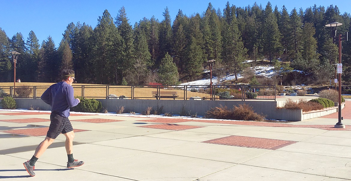
Monday, it hit 52 degrees in Coeur d'Alene. People were out skating, biking and sitting at McEuen Park enjoying the sunshine. Bear Paw Cookies had its Sherman Avenue window wide open, as if it were summer.
The National Weather Service is predicting a Friday high of 61 degrees in Post Falls, which would mark a new March 5 record. But Harris said the pattern of cooler temperatures at night, the smaller snowpack and a drier forecast will keep any flooding to a minimum, if at all.
“If we were to have heavy spring rains, that would create a flood situation in the areas along the rivers and Lake Coeur d’Alene,” he said. “But those rains just aren’t in the forecast. I’m not overly concerned now, because it looks like we’re going to be a little drier. Maybe we’ll get melting in stages, rather than all at one time. We just don’t know yet, but I don’t see much precip in the next week or 10 days. Maybe a little next week, but it’s pretty dry and sunny.”
Harris said the less-than-average snowpack is a result of extremes: October’s early snowfalls and heavy snows in February are countered by the lightest Christmas-to-Valentine’s Day on record. That six-week stretch produced only 4 inches of snow, besting the previous mark of only 4.4 inches in 1944.
“We’re in a pattern of unbelievable extremes,” he said. “There is no normal. We’re either way above normal, moisture-wise and snowfall-wise, or we don’t get anything.”
But Harris said the dry spell over the next week shouldn’t be interpreted as an end to winter.
“We could still get 6 inches of snow in March or early April, which would put us up near 60 [inches],” he said. “Our normal is 69.8, so we’re not going to be that far off, despite having the most snowless mid-winter ever recorded.”
ARTICLES BY CRAIG NORTHRUP

Partnership pulling together support for housing assessment
The Regional Housing and Growth Issues Partnership is looking to gather data about the area's housing crisis.

Employers feel squeeze with labor shortage
Business owners cite enhanced unemployment benefits among the reasons behind the challenge to hire.

Independence Point trashed; city says that's nothing new
The police have dismissed online rumors of a teenage party run amok, while Parks and Rec said Wednesday night's trash heap was nothing they haven't seen before.