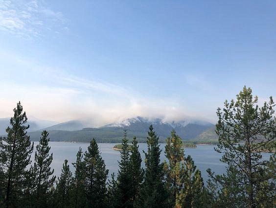
Margaret Fire grows to over 1,000 acres
TAYLOR INMAN | Hagadone News Network | UPDATED 3 years, 3 months AGO
Taylor Inman covers Bigfork and the north shore for the Bigfork Eagle and hosts News Now and other podcasts for the Daily Inter Lake. Originally from Kentucky, Taylor started her career at the award-winning public radio newsroom at Murray State University. She worked as a general assignment reporter for WKMS, where her stories aired on National Public Radio, including the show “All Things Considered.” She can be reached at 406-758-4440 or at [email protected]. | September 12, 2022 9:15 AM
The Margaret Fire burning in the Hungry Horse Reservoir is 1,077 acres in size. An update from Inciweb on September 10 said fire activity on that day consisted of mostly backing and smoldering fire due to lower temperatures and higher relative humidity values. It was reported to be burning on the ridge north of Margaret Lake and is on the upper third of the slope in the steep rocky terrain.
The fire has burned over Forest Service Road 895E, which is closed to all traffic. Forest Service trail 410 is also closed to all traffic. Forest Service roads 895 and 895F remain open.
Fire personnel were in the area on September 9 to continue assessing fire growth in relation to values at risk and update public information. The fire was initially spotted by Baptiste Lookout on August 22 and was believed to have been started by lightning. It is burning around 13.5 miles east of Bigfork.
According to the National Weather Service in Missoula, the area could see some rain early this week and some lower temperatures, followed by a slight chance of thunderstorms on Wednesday night. It is expected to clear up and have temps that top out in the mid 70s by the end of the week.
Given the fire location, steep rocky terrain, and limited access, the strategy will be point protection of values at risk. There are currently 10 personnel assigned to the fire. Hungry Horse Ranger District will continue to patrol this fire from the ground and air, keep the public informed on changes in fire activity, and evaluate the need for additional trail, road, and area closures.
ARTICLES BY TAYLOR INMAN

New nonprofit brings youth woodworking classes to Bigfork
Fourth through eighth graders in Bigfork can learn the basics of woodworking with skilled Flathead Valley instructors during a new eight-week course coming to the Bigfork Art and Cultural Center.

Blacktail Mountain Ski Area sets opening for Christmas Eve
Christmas Eve will mark the start of seven-day-a-week operations, which will continue through Jan. 4, according to a release from the ski area.

Christmas magic: Lakeside resident spreads cheer with elf character
Silver Belle is always excited to meet new people and help them get up to the North Pole to meet Santa Claus during the Journey to the North Pole cruises, which take place every holiday season on Lake Coeur d'Alene.

