Floodwaters recede in Shoshone County
JOSH McDONALD | Hagadone News Network | UPDATED 13 hours, 57 minutes AGO

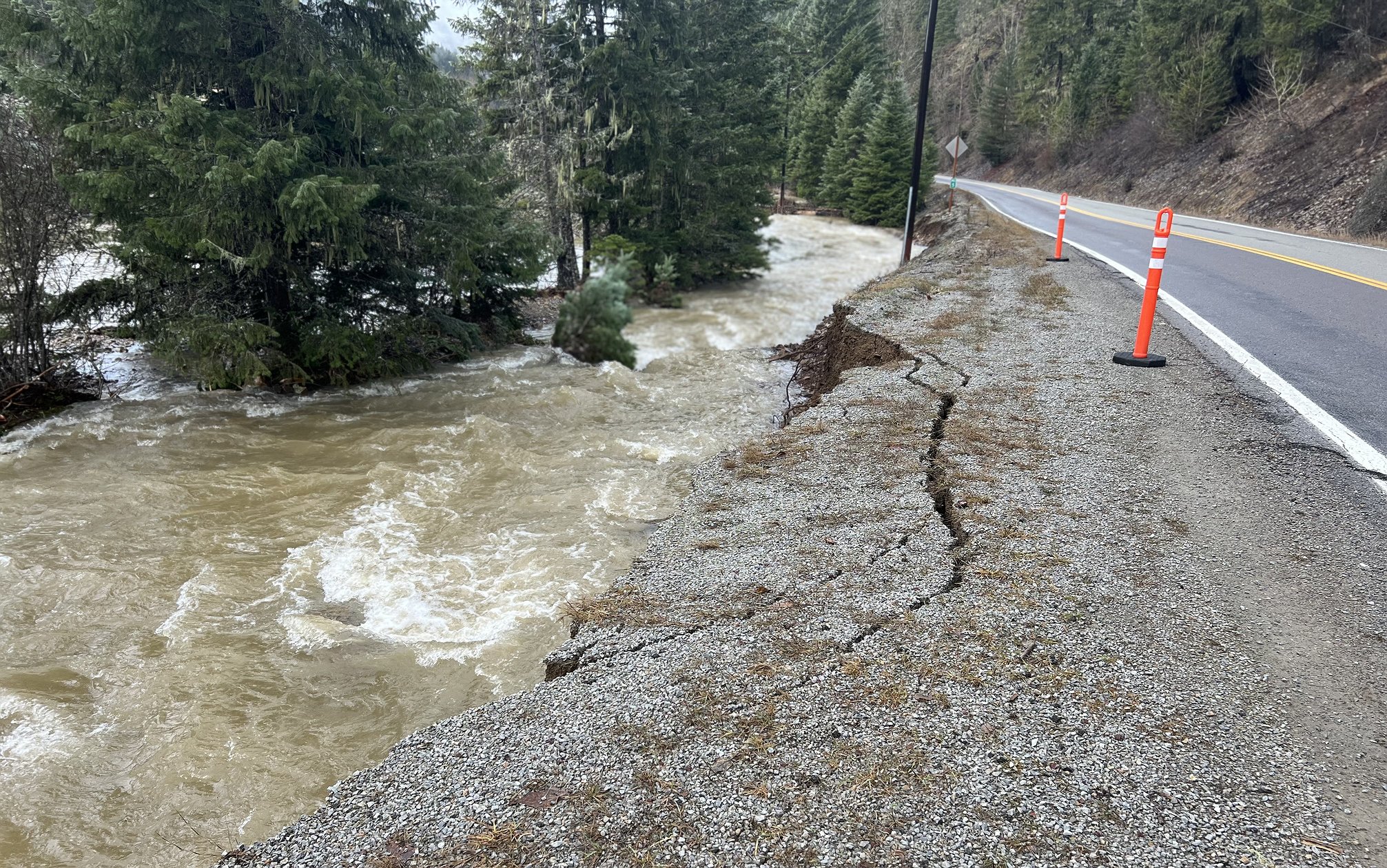
This section of Prichard Creek Road has much of its base layer washed out due to fast-moving floodwater crashing against it.
JOSH McDONALD

A section of the shoulder/bank of Prichard Creek Road is slowly slipping into the creek.

On Thursday, the lower section of the popular North Fork Coeur d'Alene River summer diving spot known as 'the rock,' was entirely underwater. On Saturday morning, the water levels have receded significantly.

Several trees have been swept into the middle of the Coeur d'Alene River, either from bank erosion from flooding or because of recent high winds.

On Thursday, water levels on the Coeur d'Alene River were mere feet from the bottom of the East Canyon Road Bridge. Two days later, the river remains high, but the levels have dropped significantly.
The water levels may have dropped, but Thursday’s historic flooding left lasting effects across the Silver Valley.
Conditions worsened quickly as high temperatures and heavy rain melted recent snow in the higher elevations, swelling tributaries and flooding much of the Coeur d’Alene and St. Joe rivers.
Along the North Fork Coeur d’Alene River, concerns over two key areas prompted Shoshone County commissioners to declare a state of emergency Thursday afternoon. Those areas included sections of Prichard Creek Road and Beaver Creek Road, where erosion threatened to wash out the roads entirely.
Shoshone County Public Works Director Jessica Stutzke said crews spent most of Thursday and Friday armoring the banks of the tributaries near the roads. The county partnered with the U.S. Forest Service to temporarily divert water.
“With significant efforts and working well into the night, we were able to armor lengthy sections of Prichard Creek Road and Beaver Creek Road,” Stutzke said Friday night. “There is still a lot more work to be done up there, but when we are finished, we will be able to open the road to traffic. We are watching another section of Prichard Creek Road and will armor that section if it becomes necessary.”
Several roads remained closed Saturday, according to the Shoshone County Sheriff’s Office, including Elk Prairie Road into Calder, CCC Road and sections of Old River Road. Other roads in Shoshone, Kootenai and Benewah counties still have water or debris and should be traveled cautiously.
“The situation is getting better and the water is receding more every hour,” Shoshone County Emergency Manager Dan Martinsen said. “Flood water elevation should continue to drop over the weekend; however, rain is forecast for early next week with hopefully snow later in the week.”
As of 2 p.m. Saturday, the St. Joe River at Calder measured about 12.98 feet, just under its 13-foot minor flood stage after cresting late Friday. The Coeur d’Alene River at Cataldo stood at 42.67 feet, in the action stage and close to minor flooding. Lake Coeur d’Alene was near 2,126.6 feet, less than 2 feet below its typical summer maximum, and is expected to rise slightly as runoff continues.
Martinsen said several properties along both rivers and their tributaries sustained significant damage, but the full extent won’t be known until water levels return to seasonal norms.
The Shoshone County Sheriff’s Office will continue posting road condition updates on its Facebook page. A video showing some of the bank armoring by Shoshone County Public Works can be found on the News-Press Facebook page.
 A section of the shoulder/bank of Prichard Creek Road is slowly slipping into the creek.
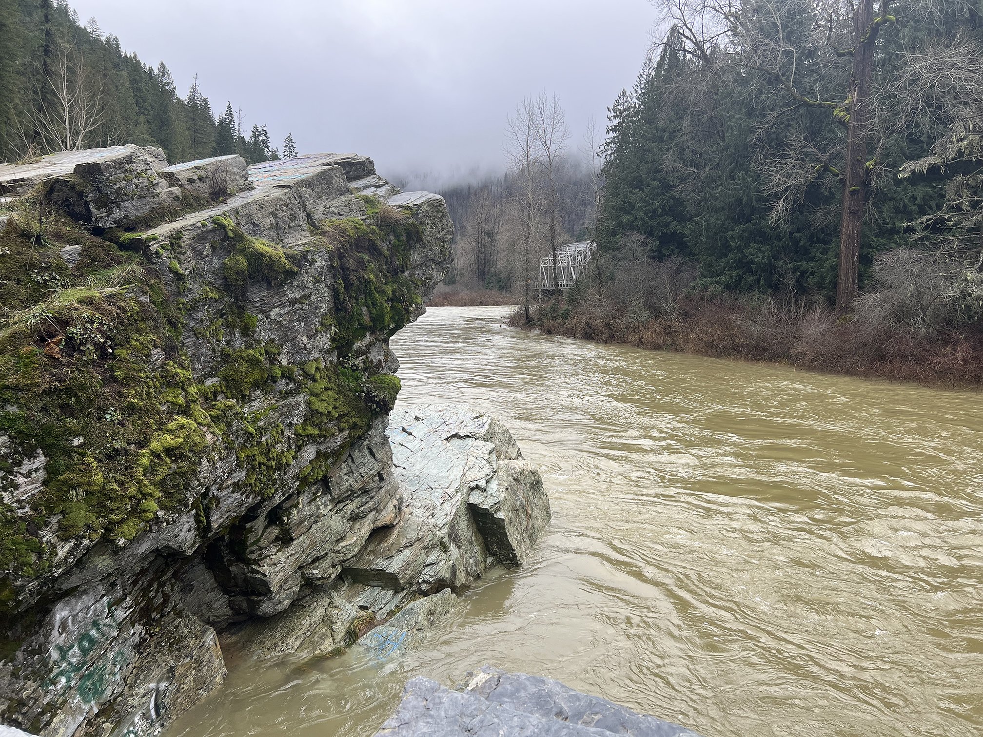 On Thursday, the lower section of the popular North Fork Coeur d'Alene River summer diving spot known as 'the rock,' was entirely underwater. On Saturday morning, the water levels have receded significantly.
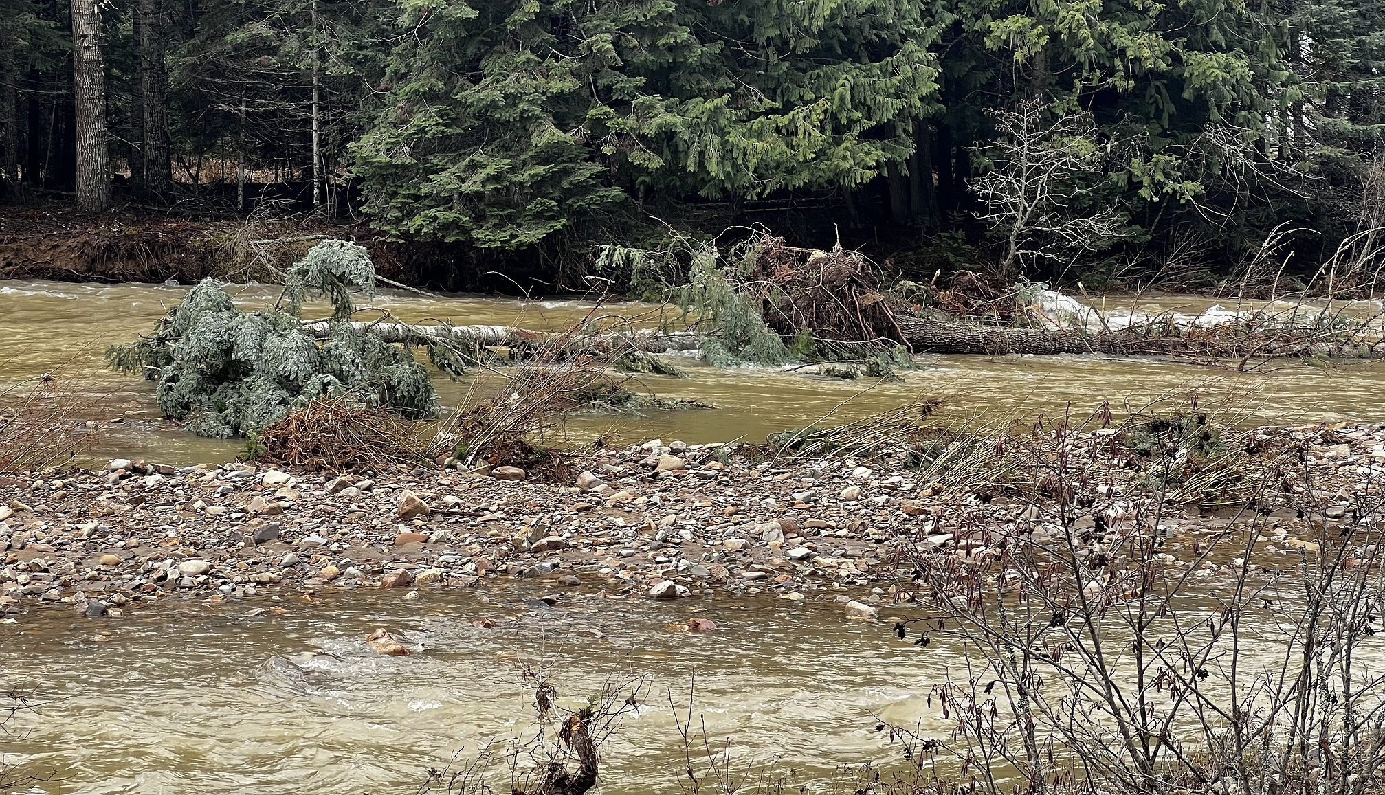 Several trees have been swept into the middle of the Coeur d'Alene River, either from bank erosion from flooding or because of recent high winds.
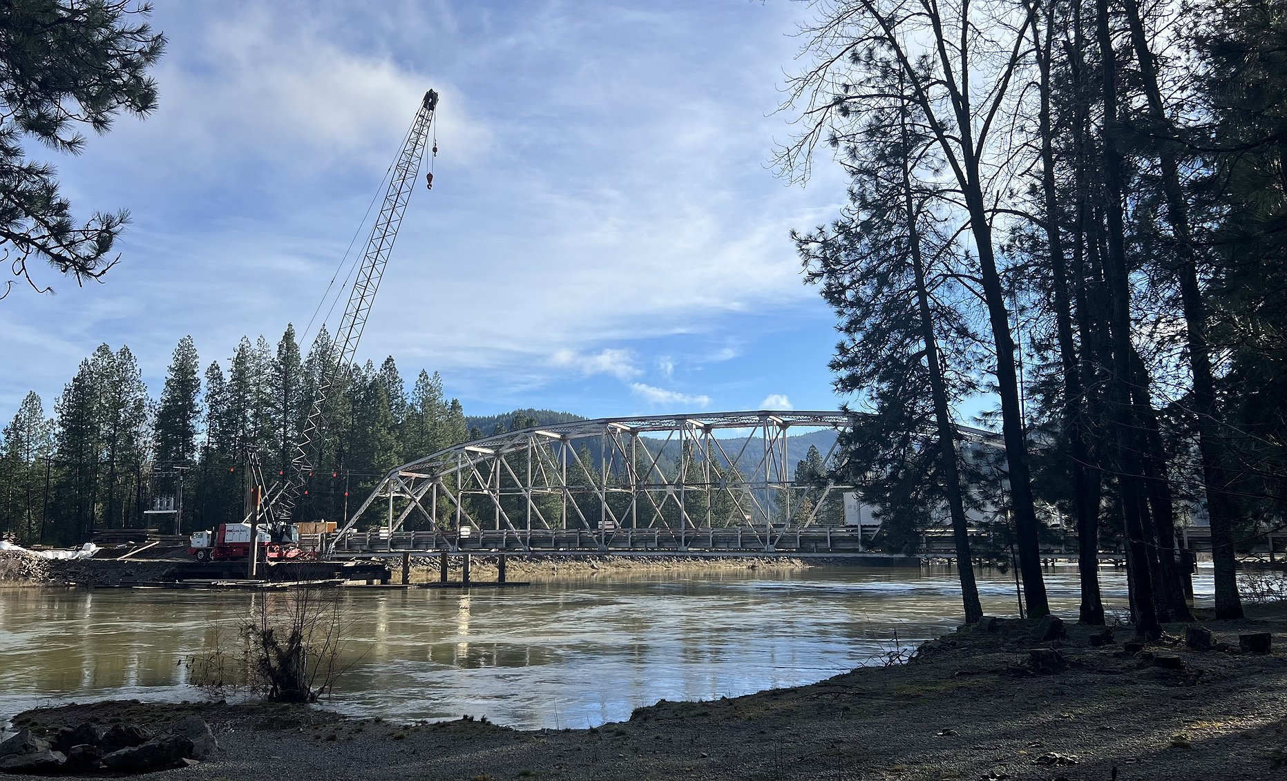 On Thursday, water levels on the Coeur d'Alene River were mere feet from the bottom of the East Canyon Road Bridge. Two days later, the river remains high, but the levels have dropped significantly.
ARTICLES BY JOSH MCDONALD

Floodwaters recede in Shoshone County
Several roads remain closed
Several roads remained closed Saturday, according to the Shoshone County Sheriff’s Office, including Elk Prairie Road into Calder, CCC Road and sections of Old River Road. Ot
Floodwaters recede in Shoshone County
