
Crews boost lines ahead of winds
CAROLINE LOBSINGER | Hagadone News Network | UPDATED 2 months, 3 weeks AGO
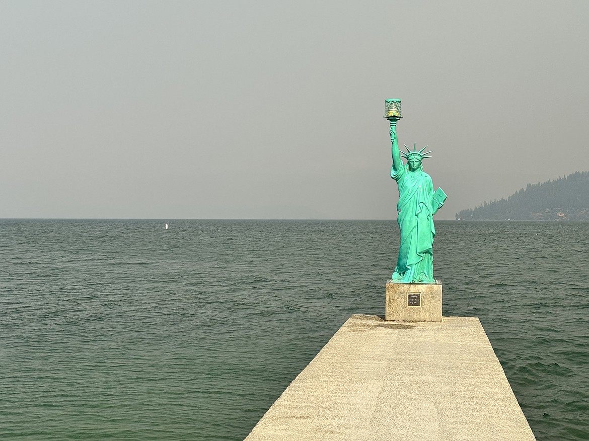
Wildfire smoke blocks the view at Sandpoint City Beach.
Photo by CAROLINE LOBSINGER
I grew up in the Tri-Cities, Wash., and have always loved to write. I attended the University of Washington, where I earned a double major in journalism and political science, with an area of emphasis in history. I am the fifth out of six kids — don't believe any of the stories that my siblings tell. To be able to tell others stories and take photos for a living is a dream come true — and I considered myself blessed to be a community journalist. When I am not working, I enjoy spending time with family and friends, hiking and spending time outdoors, genealogy, reading, and watching the UW Huskies and the Seattle Seahawks. I am a servant to my cat, Frankie, who yes, will eat anything and everything in sight … even wedding cookies. | August 1, 2026 8:00 PM
BONNERS FERRY — With winds kicking up throughout the day, Northern Rockies Team 1 crews were preparing to hold the line in what looked to be a long night on the Upper Smith Fire, officials said Saturday afternoon.
"Yeah, it's going to be a fight today," Trevor Unsworth, Northern Rockies Team 1 operations section chief, said in a briefing posted to the Idaho Panhandle National Forest Facebook page early Saturday evening. "The winds are blowing super hard up there."
The region is under a red flag warning — which indicates conditions, including winds and low humidity, are primed for dangerous wildfire behavior — through 11 p.m. Saturday. The National Weather Service predicted southwest winds of 20 to 25 mph with gusts as high as 30 to 40 mph.
The conditions could result in a rapid spread of fire for any new or existing fires, NWS officials said in the warning.
With some of the eastern flank being somewhat sheltered by a rocky outcropping that fire crews are working to tie control lines to, Unsworth said efforts Saturday have gone well.
"But the guys are gonna be working a long shift tonight to try to hold on to that stuff on the east flank," he added.
An air inversion trapped smoke closer to the ground with air quality index readings of 110 in Boundary County and 143 in Bonner County, both considered unhealthy for sensitive groups. Older adults, children and teens, as well as those with heart or lung disease, should limit their exposure.
The fire has burned roughly 2,194 acres since it was reported July 8 following a lightning strike in the overnight hours between July 7 and July 8. There are 361 personnel assigned to the fire, including six helicopters, 10 hand crews, 13 engines, 14 water tenders and assorted heavy equipment.
Located roughly 20 miles northwest of Bonners Ferry in the Smith Creek drainage of the Kootenai River Valley, the fire is roughly 12% contained. The drop in containment reflects firing operations creating additional uncontained edges. As part of firing operations, crews are deliberately setting small fires in a controlled manner to remove fuel loads ahead of a main fire.
Northern Rockies Team 1 crews spent Friday and Saturday working to strengthen the fire's eastern flank in preparation for the high winds. Saturday, firefighters spent part of the day patrolling and mopping up control lines from West Side Road to Smith Creek as well as securing the Long Canyon Creek area and addressing any additional spot fires. Crews will use these previously burned areas and lighter fuels south of Long Canyon Creek to limit further spread.
After spot fires crossed to the south side of Long Canyon Creek, officials said crews used aviation resources to limit spread and conducted strategic firing operations to bring the fire to the pre-planned containment line that connects to the 2015 Parker Ridge burn scar.
Fireline along the southwest corner, Smith Creek and the west-side avalanche chute continued to hold, Northern Rockies Team 1 officials said.
The fire is 2,194 acres and 10-12% contained; the reduced containment percentage reflects additional uncontained fire edge created by the firing operations, not the loss of previously contained line. A Red Flag Warning is in effect for critical fire-weather conditions through this evening. The wind will test control lines, particularly near Long Canyon Creek, where terrain may channel stronger gusts. For nearly two weeks, firefighters have prepared and strengthened primary and contingency control lines and completed structure-protection work along the fire’s eastern side, positioning crews to respond to today’s high winds and protect homes, agricultural lands and other values in the valley. Fire behavior could become very active, with torching, short crown runs and long-range spotting possible if conditions align. Crews will remain alert for unexpected fire movement, and aircraft will be used as wind conditions allow.
Residents near the Upper Smith Fire remain under "Go" status under the state's Ready-Set-Go evacuation protocol. Under "Ready" status, residents are advised to have a plan to evacuate if necessary; under "Set" status, residents are advised to begin putting their plan into place. Under "Go" status, residents are advised to leave immediately due to an imminent threat.
Residents were asked to evacuate Tuesday afternoon as a precautionary measure while Northern Rockies Team 1 crews work to connect to the rock band and take advantage of the terrain to create a natural control line.
Deputies are manning a roadblock set up at the intersection of Big Bend and Kerr Lake roads to protect property and homes in the evacuation zone. The Boundary County Fairgrounds has been designated as a rally point for residents, Stolley said.
Northern Rockies said a community meeting may be held early in the coming week with more details expected Sunday.
Other fires in the region include:
• Porcupine Fire — The 4-acre fire located in Bonner County's Porcupine Creek drainage was reported July 24. Early aviation support was critical as firefighters on the ground worked to access the fire in remote and challenging terrain, officials said. A fireline has been completed around both flanks of the fire, but cliffs and other features make further handline construction unfeasible. The fire is 20% contained.
• Turner Fire — Located 5 miles south of Copeland, the fire is 100% contained and burned 681 acres. All evacuation levels have been lifted from the fire.
• Hidden Valley Fire — Located in the Rathdrum area, the fire has burned 0.25 acre, and forward progress has stopped after a wet line was created around the fire.
Temporary flight restrictions are in effect over both fires to ensure the safety of suppression aircraft. Both personal aircraft and drones are included in the TFRs. Northern Rockies Team 1 officials said there have been several incidents of private drones flying in the TFR zone, which prevents the team's helicopters and planes from taking off.
Both Smith Creek Road and Long Canyon Trail have been closed to public travel. Closures in the Westside and Kerr Lake Road areas, as well as a closure of Riverside Street, are connected to county projects. The Parker Ridge Trail is in the process of being closed due to its access to the bridge construction and its proximity to road prep work related to the Upper Smith Fire.
Information: InciWeb.wildfire.gov
ARTICLES BY CAROLINE LOBSINGER

Wellness fair puts focus on health
The Wellness & Connection Fair is bringing together local health and wellness professionals together in Sandpoint for a day of presentations, activities and community resources.

BCSD pays share of ISBT shortfall
District opts to make lump sum payment
Boundary County School District paid $217,000 to cover its share of the Idaho School Benefit Trust's $13 million shortfall.

Deadline extended for 'Valor' stories
The Valor publication is gathering photos, military service details and personal stories from Boundary County veterans and military families. Featured profiles highlight local service members' contributions, achievements and sacrifices across generations.