
Officials lift Upper Smith evacuation warnings
CAROLINE LOBSINGER | Hagadone News Network | UPDATED 2 months, 3 weeks AGO
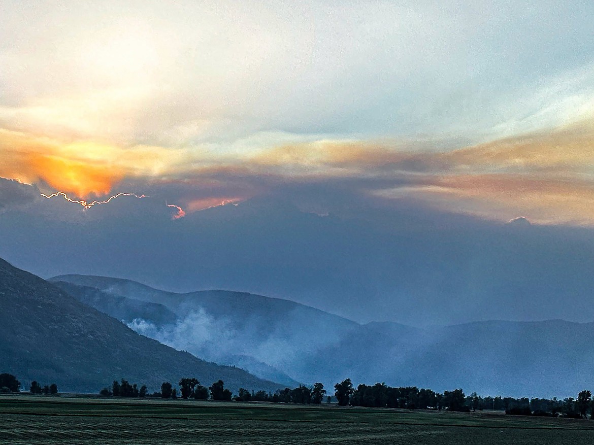
A view of the Upper Smith Fire in the early hours.
Photo courtesy USDA FOREST SERVICE
I grew up in the Tri-Cities, Wash., and have always loved to write. I attended the University of Washington, where I earned a double major in journalism and political science, with an area of emphasis in history. I am the fifth out of six kids — don't believe any of the stories that my siblings tell. To be able to tell others stories and take photos for a living is a dream come true — and I considered myself blessed to be a community journalist. When I am not working, I enjoy spending time with family and friends, hiking and spending time outdoors, genealogy, reading, and watching the UW Huskies and the Seattle Seahawks. I am a servant to my cat, Frankie, who yes, will eat anything and everything in sight … even wedding cookies. | August 4, 2026 1:00 AM
BONNERS FERRY — The lines held — and now residents near the eastern flank of the Upper Smith Fire can go home.
Boundary County Sheriff Travis Stolley spread the news after a Monday morning consultation with Northern Rockies Team 1 officials that all evacuation zones near the fire were being dropped to "Ready" status.
Under "Ready" status, residents are advised to have a plan to evacuate if necessary; under "Set" status, residents are advised to begin putting their plan into place. Under "Go" status, residents are advised to leave immediately due to an imminent threat.
A community meeting — the third connected to the Upper Smith Fire — is planned for Tuesday, Aug. 4, at Mount Hall Elementary. The meeting will start at 6 p.m.
Northern Rockies Team 1 fire crews continue to secure the Upper Smith Fire following Saturday’s wind event. As part of that effort, helicopter bucket drops were used Sunday morning in the 2015 Parker Ridge Fire scar, decreasing fire activity to the point that the drops were no longer needed by Sunday afternoon.
"No control lines along the fire’s eastern side were breached, and no homes, infrastructure or other critical values were threatened," Northern Rockies officials said on InciWeb, an interagency incident information management site.
On Monday, Northern Rockies Team 1 officially increased containment on the fire to 40%, primarily along the fire’s western side near the avalanche chute and along the northern side near Smith Creek.
"That stuff all withstood the wind event (Saturday) without a whole lot of effort, actually with no effort from the folks on the ground," Trevor Unsworth, Northern Rockies Team 1 operations section chief, said in a Sunday briefing. "The stuff I've walked in looks super good. It obviously hasn't moved or shown a lot of life in quite a few days."
On Monday, Northern Rockies crews were expected to continue mopping up along the fireline near Long Canyon Creek as well as patrol containment lines from the avalanche chute east along Smith Creek. Structure protection crews will remain in place and test sprinkler systems.
"Minimal fire behavior is expected, with mostly creeping and smoldering under very light winds," officials said. "Smoke may be visible from the fire’s interior, but the remaining heat is currently not threatening containment lines."
The fire has burned roughly 2,305 acres since it was reported July 8 following a lightning strike in the overnight hours between July 7 and July 8. There are 346 personnel assigned to the fire, including six helicopters, eight hand crews, 11 engines, 11 water tenders and assorted heavy equipment.
The fire, located 20 miles northwest of Bonners Ferry, is 40% contained.
Other fires in the region include:
• Porcupine Fire — Located in Bonner County's Porcupine Creek drainage, the fire grew to 10 acres as a result of Saturday's winds.
Air resources continue to conduct water drops while crews scout additional options for indirect confinement of the fire, which was reported July 24. Due to the steep, rocky and challenging terrain, all direct extinguishment actions (working directly adjacent to the edge of the fire) have been completed. Indirect options include handline, machine line and natural and man-made features where fire can be held.
• Turner Fire — Located 5 miles south of Copeland, the fire is 100% contained and burned 681 acres. All evacuation levels have been lifted for the fire.
Information: InciWeb.wildfire.gov
ARTICLES BY CAROLINE LOBSINGER

Wellness fair puts focus on health
The Wellness & Connection Fair is bringing together local health and wellness professionals together in Sandpoint for a day of presentations, activities and community resources.

BCSD pays share of ISBT shortfall
District opts to make lump sum payment
Boundary County School District paid $217,000 to cover its share of the Idaho School Benefit Trust's $13 million shortfall.

Deadline extended for 'Valor' stories
The Valor publication is gathering photos, military service details and personal stories from Boundary County veterans and military families. Featured profiles highlight local service members' contributions, achievements and sacrifices across generations.