
Upper Smith Fire holds at 2,305 acres
CAROLINE LOBSINGER | Hagadone News Network | UPDATED 2 months, 2 weeks AGO
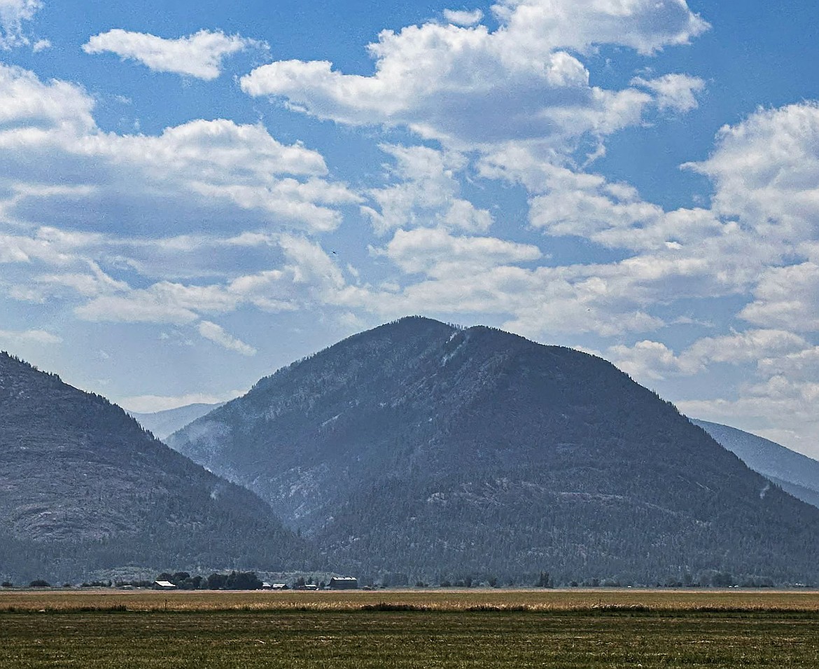
A view of the Upper Smith Fire from the Kootenai River Valley on Wednesday, Aug 5.
Photo courtesy USDA FOREST SERVICE
I grew up in the Tri-Cities, Wash., and have always loved to write. I attended the University of Washington, where I earned a double major in journalism and political science, with an area of emphasis in history. I am the fifth out of six kids — don't believe any of the stories that my siblings tell. To be able to tell others stories and take photos for a living is a dream come true — and I considered myself blessed to be a community journalist. When I am not working, I enjoy spending time with family and friends, hiking and spending time outdoors, genealogy, reading, and watching the UW Huskies and the Seattle Seahawks. I am a servant to my cat, Frankie, who yes, will eat anything and everything in sight … even wedding cookies. | August 6, 2026 1:00 AM
BONNERS FERRY — With a transfer to a new incident management team on the horizon, Northern Rockies Team 1 firefighters continue to hold the Upper Smith Fire to minimal growth.
While conditions are dry, Sandpoint District Ranger Andrew Skowlund, standing in for his counterpart Heather Fuller of the Bonners Ferry Ranger District, said the Northern Rockies team will be leaving the next incident management team and local crews in good shape.
"Things are dry and it's hot," Skowlund said. "But I think that we are in a very good place from all of the hard work that Northern Rockies Team 1 has done to get us there."
Skowlund and other officials praised the team's work that set fire crews up for success. But that doesn't mean the fire will go completely away or residents won't see smoke over the coming weeks.
"This is going to be a marathon … and it's going to be season-ending events that put this out," he added.
Of the area where fire is seen, Northern Rockies officials said the most active area of the Upper Smith Fire remains in the Long Canyon Creek area, where the fire continues backing and flanking to the southwest, away from homes and other values at risk.
Much of the effort on the fire over the past three weeks has been to loop around the fire using the region's terrain and previous burn scars to help contain the fire, Scott Schrenk, Northern Rockies operations section chief, said.
When Northern Rockies crews arrived, they set three possible options. The first was a control line higher up on the hillside, a secondary fallback line and Westside Road at the valley bottom.
"So, long story short, we did use the upper line the whole way," Schrenk said. "We obviously got some spotting and whatnot, but everything was contained between that secondary fallback line and our main primary handline that we put in."
While it involved some tough and long shifts, Schrenk told the roughly two dozen residents who attended the meeting that the work made all the difference when it came to the Aug. 1 windstorm that hit the region.
Since the Upper Smith Fire was reported July 8, the lightning-sparked fire has burned roughly 2,305 acres, with no significant growth in size for the past several days. The fire, located 20 miles northwest of Bonners Ferry, remains 40% contained.
There are 253 personnel assigned to the fire, including six helicopters, five hand crews, nine engines and five water tenders.
Fire within the 2015 Parker Ridge Fire scar remains scattered because fuels are not continuous enough to support sustained spread, Northern Rockies Team 1 officials told roughly two dozen residents who attended Tuesday's community meeting.
Minimal fire behavior is expected where the fire has reached established control lines. However, interior smoke and possibly smoke columns will continue to be visible as unburned heavy fuels smolder and burn on the Upper Smith Fire.
Wednesday, crews planned to use water and hose lays to secure and mop up fireline from the Long Canyon Creek area east toward Smith Creek. Also, firefighters will patrol containment lines and spot fires east of the main fire and helicopters are available to support ground crews with bucket drops as needed.
Fire danger in the region is rated as extreme, the highest possible level. Under extreme fire danger, fires typically start more quickly and burn more intensely. All fires are considered dangerous and can spread quickly with more intensity, according to the U.S. Forest Service website.
Public land management agencies and Tribal partners will be raising fire restrictions to Stage II on Friday on the Sandpoint, Priest Lake and Bonners Ferry ranger districts. Under Stage II fire restrictions, campfires are generally banned and motorized vehicles are limited to designated roads and trails among other restrictions.
"We're trying to prevent human starts," Eric Sjoquist of the Idaho Department of Lands told community members. "Mother Nature doesn't care what the fire danger is … so be careful out there."
Conditions and fuels near the fire continue to be near record levels, with Northern Rockies fire behavior analyst LaWen Hollingsworth comparing fuel loads in the fire area to what you might see in kiln-dried hardwood used to build furniture or construction materials such as 2-by-4s.
"The fuels are very dry, and the only thing that's going to actually change the situation is a lot of rain, which typically is going to come in September," she said. "That's about the only thing that's going to turn the corner with how dry these fuels currently are."
Bruno Rodriguez, National Weather Service incident meteorologist assigned to Northern Rockies Team 1, said the area saw relatively mild winds compared to much of the region, which saw gusts in excess of 40 mph. While gusts in Boundary County were recorded at 20 to 30 mph, many of the areas near the fire that were more sheltered saw even lower wind gusts.
While another wind event could happen over the next few days, Rodriguez said speeds are expected to be "well below" what the areas saw Aug. 1.
Forecasts call for continued dry weather with minimal rain expected through the rest of the month.
"The average precipitation in Bonners Ferry in August is just over half an inch. That's comparable to Las Vegas in August," Rodriguez said. "To put that into perspective, it's not entirely surprising to see stretches of dry weather like this that we've been seeing."
Northern Rockies Team 9, a Type 3 incident management team, will assume command of the fire Thursday, Aug. 6.
Temporary flight restrictions are in effect to ensure the safety of suppression aircraft. Both personal aircraft and drones are included in the TFRs.
Northern Rockies Team 1 officials said that, since the fire was first reported, there have been several incidents of private drones flying in the TFR zone, which prevents the team's helicopters and planes from taking off.
Closures are in place for Smith Creek Road, the Long Canyon Trail and the Parker Ridge Trail. Closures in the Westside and Kerr Lake Road areas, as well as a closure of Riverside Street, are connected to county projects.
Other fires in the region include:
• Porcupine Fire — Located in Bonner County's Porcupine Creek drainage, the fire grew to 10 acres as a result of Saturday's winds.
Air resources continue to conduct water drops while crews scout additional options for indirect confinement of the fire, which was reported July 24. Due to the steep, rocky and challenging terrain, all direct extinguishment actions (working directly adjacent to the edge of the fire) have been completed. Indirect options include handline, machine line and natural and man-made features where fire can be held.
• Turner Fire — Located 5 miles south of Copeland, the fire is 100% contained and burned 681 acres.
Information: InciWeb.wildfire.gov
ARTICLES BY CAROLINE LOBSINGER

Wellness fair puts focus on health
The Wellness & Connection Fair is bringing together local health and wellness professionals together in Sandpoint for a day of presentations, activities and community resources.

BCSD pays share of ISBT shortfall
District opts to make lump sum payment
Boundary County School District paid $217,000 to cover its share of the Idaho School Benefit Trust's $13 million shortfall.

Deadline extended for 'Valor' stories
The Valor publication is gathering photos, military service details and personal stories from Boundary County veterans and military families. Featured profiles highlight local service members' contributions, achievements and sacrifices across generations.