
Dry conditions fuel wildfire growth
CAROLINE LOBSINGER | Hagadone News Network | UPDATED 2 months, 2 weeks AGO
I grew up in the Tri-Cities, Wash., and have always loved to write. I attended the University of Washington, where I earned a double major in journalism and political science, with an area of emphasis in history. I am the fifth out of six kids — don't believe any of the stories that my siblings tell. To be able to tell others stories and take photos for a living is a dream come true — and I considered myself blessed to be a community journalist. When I am not working, I enjoy spending time with family and friends, hiking and spending time outdoors, genealogy, reading, and watching the UW Huskies and the Seattle Seahawks. I am a servant to my cat, Frankie, who yes, will eat anything and everything in sight … even wedding cookies. | August 9, 2026 1:00 AM
BONNERS FERRY — Increased fire activity in the old Parker Creek burn scar prompted officials to boost evacuation protocols near part of the Upper Smith Fire as conditions caused the fire to grow overnight.
According to Watch Duty, a nonprofit app dedicated to providing real-time information during natural disasters such as wildfires, the wildfire has burned more than 3,222 acres as of early Saturday afternoon.
With activity throughout the day moving the Upper Smith Fire "well into" the burn scar, Boundary County Sheriff Travis Stolley told residents in the Parker and Copeland zones that they should be prepared to leave at a moment's notice. Deputies began contacting residents in those areas about 8:40 p.m. Friday, Stolley said in a post on the department's social media pages.
While fire activity increased along the Long Canyon drainage and along the 2015 Parker Ridge Fire footprint, a reduced fuel load in the area is expected to limit southward progression, Northern Rockies Team 9 officials said in an update on InciWeb, an interagency incident information management site.
Aircraft continue to drop water to cool the fire’s edge, with efforts concentrated on where the fire has begun burning into the old Parker Ridge burn scar. Northern Rockies Team 9 incident commander Shane Martin said handline improvement and natural features are being used to limit lateral spread as well as progression to the south. A night shift crew has been mobilized to assist those efforts.
Saturday, crews were expected to continue with hose lays and vegetation removal along and adjacent to Westside Road. Those efforts are aimed at protecting nearby barley, hay and hops fields and cattle, as well as timber and homes.
As the fire accesses heavier fuels, Northern Rockies officials said the fire is being drawn upslope through the Long Canyon drainage. As temperatures increase and humidity lowers in the afternoons, officials said fire activity is expected to increase.
There are 197 personnel assigned to the fire, including four helicopters, three hand crews, four engines and four water tenders. The fire is 32% contained.
Temporary flight restrictions are in effect to ensure the safety of suppression aircraft. Both personal aircraft and drones are included in the TFRs.
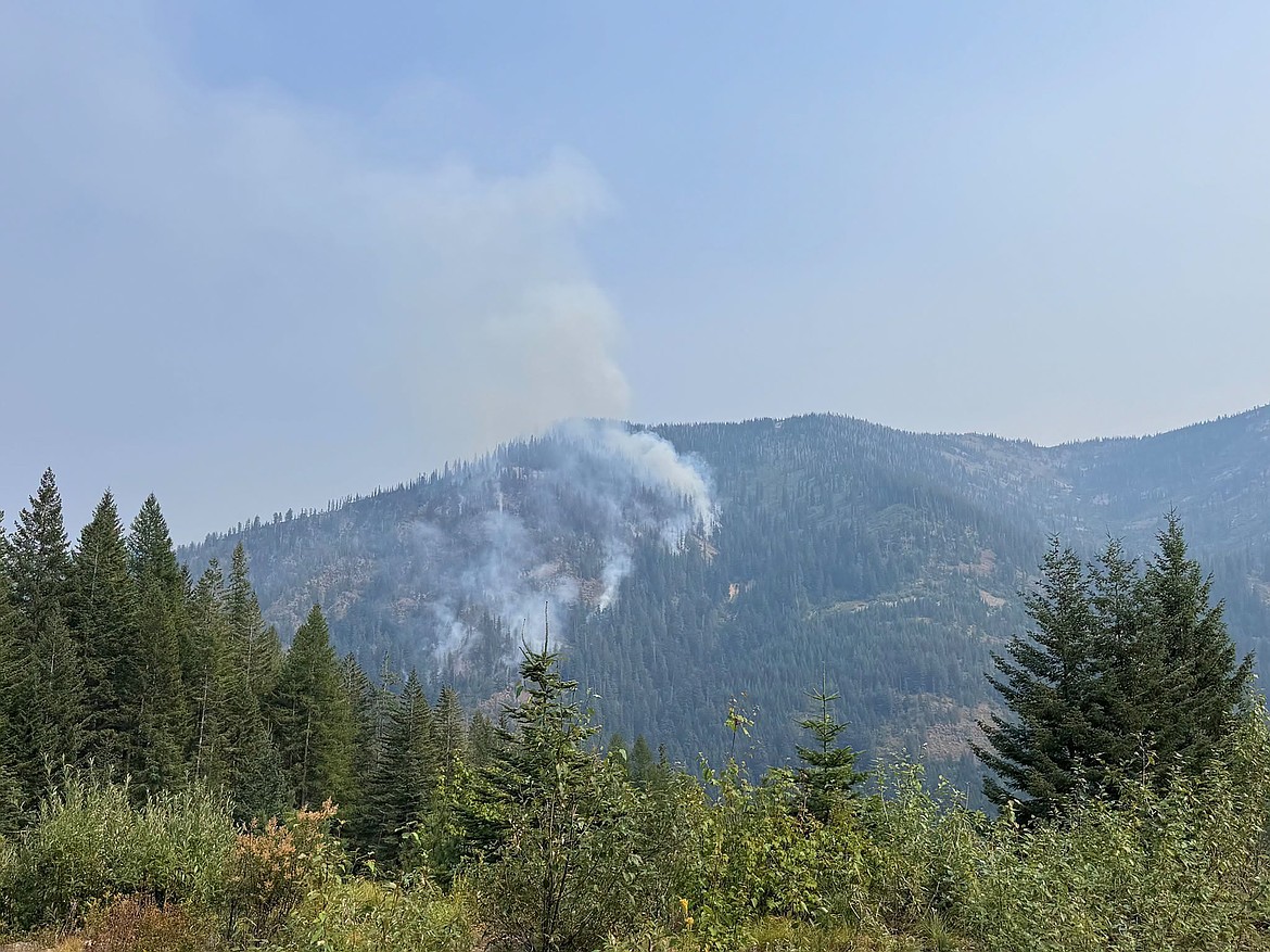
On the Porcupine Fire, the lightning-sparked fire has burned 75 acres, with most of its growth eastward toward Bee Top Mountain.
Due to the area's steep terrain and cliffs, firefighters continue to rely on air support to keep fire growth in check, and there are no options for direct fireline construction.
Fire crews will be using Porcupine Lake Trail 642 to access the fire area, and both Lake Pend Oreille and Porcupine Lake will act as dip sites for air resources. Residents and recreators are reminded to exercise caution and yield to firefighting traffic and aircraft.
"Current suppression efforts are focused on keeping the fire from crossing over the ridge and establishing on the southeast face where the threat to values at risk would increase," Idaho Panhandle National Forest officials said on InciWeb. "Due to terrain, the most effective tool in reducing spread continues to be aviation support."
Breezy winds over the weekend could lead to critical fire weather conditions continuing through Saturday. Those conditions have resulted in short uphill runs, active flanking, or the fire growing from its sides, and single-tree torching, IPNF officials said.
However, a return to near-normal temperatures and improving overnight humidity recovery are on track for the start of next week.
Initially discovered on July 24, the fire required initial attack firefighters, who were inserted into the area by helicopter, almost two days to saw an access route through heavy brush and dead and down timber.
With support from scoopers and helicopters, firefighters directly engaged the fire, building a handline around most of the fire. However, they were unable to "anchor" at the base of the fire because of its location on a cliff.
"Due to terrain, issues with escape routes, and no feasible safety zones or medevac sites, further direct effort proved unsuccessful and unsafe," IPNF officials said.
The handline was able to hold the Porcupine Fire at 3.5 acres until an Aug. 1 wind event and rollouts on the cliff face caused the fire to grow. Officials said they are working to confine the fire to an area that limits the threat to values at risk, including a communication site, recreation infrastructure and nearby homes and property.
Fire danger is rated as extreme in the region, meaning that fires of all types start quickly and burn intensely, according to local U.S. Forest Service officials.
Stage 2 fire restrictions are in effect in Bonner and Boundary counties, while Stage 1 fire restrictions are in effect in Kootenai, Shoshone and Benewah counties.
Under Stage 1 fire restrictions, campfires and stove use are prohibited except at designated recreation sites, on private property or in approved fire structures. Smoking is limited to enclosed vehicles, buildings or cleared areas free of flammable materials.
Stage 2 fire restrictions prohibit fires and campfires; smoking except within an enclosed vehicle or building, or a designated recreation area that is at least 3 feet in diameter and barren or cleared of flammable materials. In addition, "Hoot Owl" restrictions limit chainsaw and machinery operation from 1 p.m. to 1 a.m.
For more information on fire restrictions, go to bit.ly/45a7eIT. Fore more information on area fires, go to InciWeb.wildfire.gov.
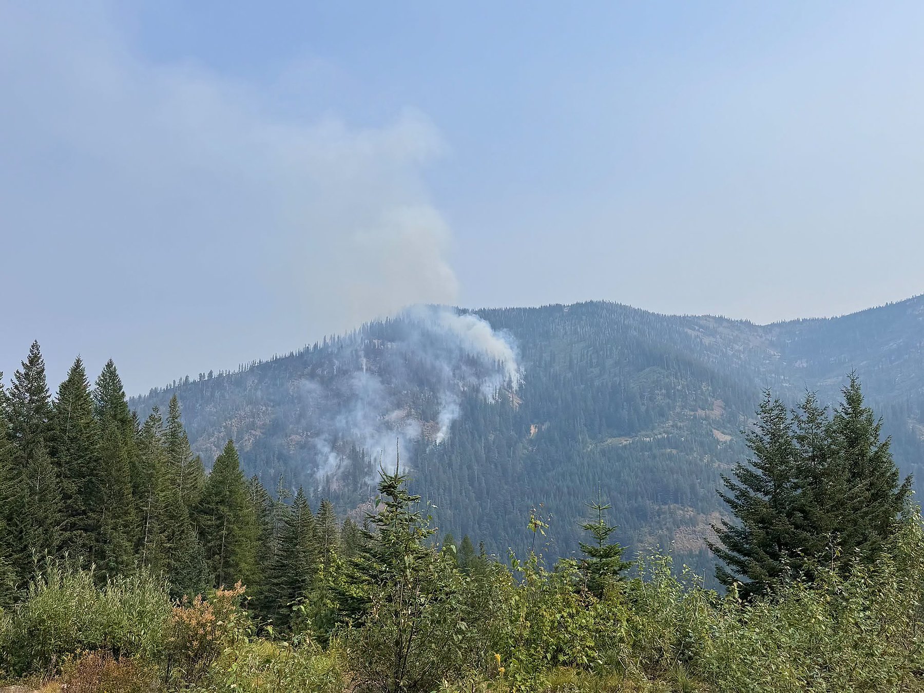 A view of the smoke on the Porcupine Fire in Bonner County. The fire, located two miles east of Porcupine Lake, has burned 75 acres.
ARTICLES BY CAROLINE LOBSINGER

Wellness fair puts focus on health
The Wellness & Connection Fair is bringing together local health and wellness professionals together in Sandpoint for a day of presentations, activities and community resources.

BCSD pays share of ISBT shortfall
District opts to make lump sum payment
Boundary County School District paid $217,000 to cover its share of the Idaho School Benefit Trust's $13 million shortfall.

Deadline extended for 'Valor' stories
The Valor publication is gathering photos, military service details and personal stories from Boundary County veterans and military families. Featured profiles highlight local service members' contributions, achievements and sacrifices across generations.