
Crews continue fight against area wildfires
CAROLINE LOBSINGER | Hagadone News Network | UPDATED 2 months, 2 weeks AGO
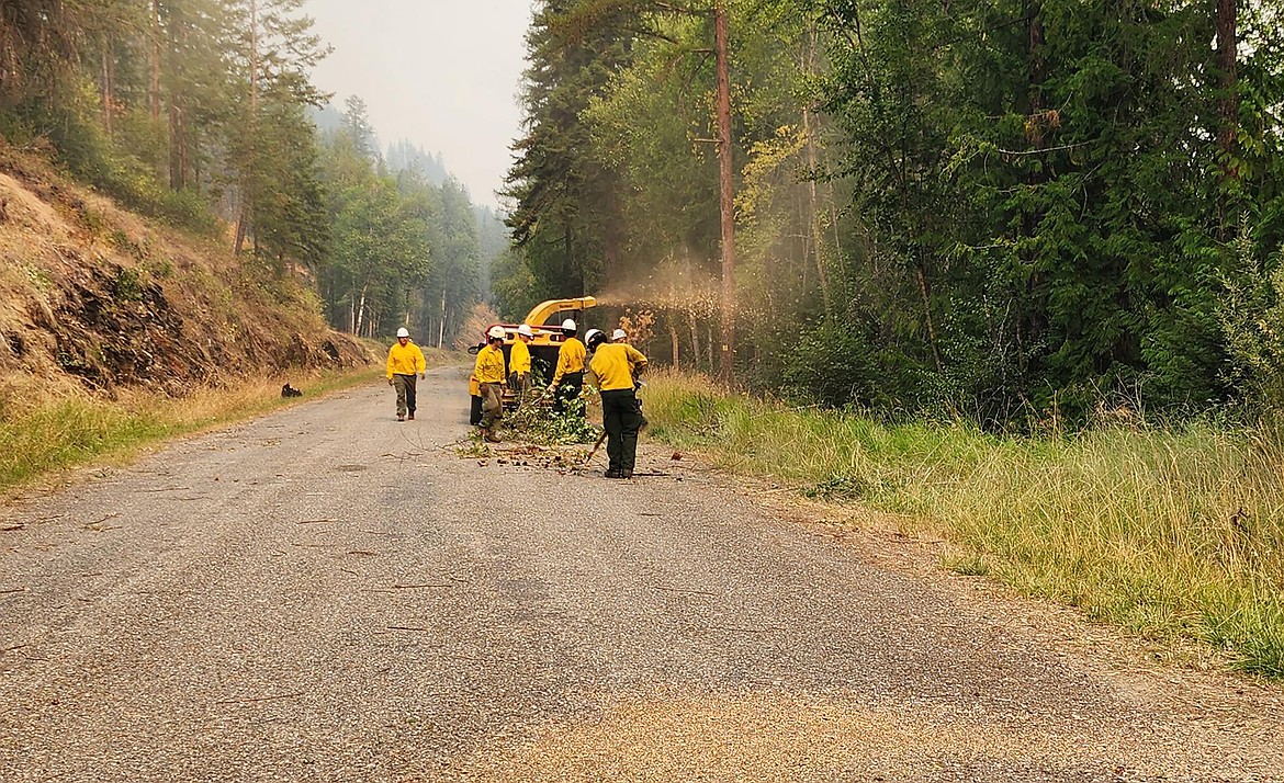
Crews work to chip trees, brush and other potential fuels on West Side Road on the Upper Smith Fire in northern Boundary County.
Photo courtesy USDA FOREST SERVICE/M. THEARD
I grew up in the Tri-Cities, Wash., and have always loved to write. I attended the University of Washington, where I earned a double major in journalism and political science, with an area of emphasis in history. I am the fifth out of six kids — don't believe any of the stories that my siblings tell. To be able to tell others stories and take photos for a living is a dream come true — and I considered myself blessed to be a community journalist. When I am not working, I enjoy spending time with family and friends, hiking and spending time outdoors, genealogy, reading, and watching the UW Huskies and the Seattle Seahawks. I am a servant to my cat, Frankie, who yes, will eat anything and everything in sight … even wedding cookies. | August 11, 2026 1:00 AM
BONNERS FERRY — Crews rappelled into the Parker Ridge area in an attempt to secure a nearby fireline by mopping up hot spots and breaking up pockets of fuel as crews continue to battle the Upper Smith Fire.
Reported after a July 8 lightning strike, the wildfire has burned more than 3,417 acres as of Monday afternoon.
Crews worked to cool heat on the fire's northwest corner Sunday and Monday after an interior flare-up was discovered Sunday morning. The efforts are aimed at protecting both a nearby fire line and the Smith Creek riparian area.
Northern Rockies officials said aerial water drops were expected to continue through Monday in an effort to protect critical values in the Kootenai River Valley.
Also, crews continue to reduce fuel loading along Westside Road with hose lays and shaded fuel breaks. Rappellers were also dropped into the Parker Ridge area and, on the western end of Smith Creek Road, operations were launched Monday to open forest roads to improve ease of access and provide alternative options for containment of the fire.
There are 170 personnel assigned to the fire, including three helicopters, three hand crews, eight engines and six water tenders. The fire is 32% contained.
Aircraft made repeated water drops Sunday and Monday to reduce heat within the interior and along the perimeter adjacent to the Parker Ridge fire footprint, Northern Rockies Team 9 officials said.
The fire's size was recently adjusted as aerial mapping resources became available, resulting in a decrease to the reported containment percentage.
"Containment is a dynamic measurement that may increase or decrease as fire behavior and conditions change," Northern Rockies officials said. "The footprint of the fire has grown, reducing the percentage; however, existing lines are holding."
Temporary flight restrictions are in effect to ensure the safety of suppression aircraft. Both personal aircraft and drones are included in the TFRs.
On the Porcupine Fire, the lightning-sparked fire has burned 75 acres, with most of its growth eastward toward Bee Top Mountain.
Due to the area's steep terrain and cliffs, firefighters continue to rely on air support to keep fire growth in check, and there are no options for direct fireline construction.
Other fires in the region include:
• Porcupine Fire — Located 2 miles east of Porcupine Lake in Bonner County's Porcupine Creek drainage, the fire has burned 108 acres.
Air support continues to be key in fighting the fire, which is located in an area with steep slopes, cliffs and rocks, preventing direct fireline construction for much of the fire.
Fire crews are using Porcupine Lake Trail 642 to access the fire area, and both Lake Pend Oreille and Porcupine Lake will act as dip sites for air resources. Residents and recreators are reminded to exercise caution and yield to firefighting traffic and aircraft.
Suppression efforts are focused on keeping the fire from crossing over the ridge and establishing on the southeast face, which would increase the threat to nearby homes, property and other at-risk values, Idaho Panhandle National Forest officials said on InciWeb, an interagency incident information management site.
With support from scoopers and helicopters, firefighters were able to directly engage the fire over the weekend, building a handline around most of the fire. However, they were unable to "anchor" at the base of the fire because of its location on a cliff.
• Autumn Lane Fire — Located in Spokane and Stevens counties, the fire has burned roughly 5,782 acres. It is now 73% contained.
Level 3 evacuations continue to be in place in portions of the area.
• Fairview Fire — Located in Spokane County, the fire has burned just over 992 acres and is 53% contained. Forward progress of the fire has been stopped.
• Old Trails Fire — Located in Spokane County, the fire has burned more than 3,175 acres and is 53% contained.
As firefighting efforts continue to progress on the Autumn Lane, Fairview and Old Trails fires, evacuation levels continue to be evaluated and updated when appropriate. However, officials said, some Level 3 evacuations remain due to the ongoing fire mop-up operations and the large number of hazardous conditions in the area.
Working alongside local firefighters, crews have successfully searched and suppressed most heat adjacent to containment lines and around structures inside the fire areas. However, officials cautioned that residual heat may persist in areas of heavy vegetation, structures and vehicles and debris piles.
Utility and transportation crews will continue inspecting and repairing infrastructure in and around fire areas.
Fire restrictions
Fire danger is rated as extreme in the region, meaning that fires of all types start quickly and burn intensely, according to local U.S. Forest Service officials.
Stage 2 fire restrictions are in effect in Bonner and Boundary counties, while Stage 1 fire restrictions are in effect in Kootenai, Shoshone and Benewah counties.
Under Stage 1 fire restrictions, campfires and stove use are prohibited except at designated recreation sites, on private property or in approved fire structures. Smoking is limited to enclosed vehicles, buildings or cleared areas free of flammable materials.
Stage 2 fire restrictions prohibit fires and campfires; smoking except within an enclosed vehicle or building, or a designated recreation area that is at least 3 feet in diameter and barren or cleared of flammable materials. In addition, "Hoot Owl" restrictions limit chain saw and machinery operation from 1 p.m. to 1 a.m.
For more information on fire restrictions, go to bit.ly/45a7eIT.
Information: InciWeb.wildfire.gov
ARTICLES BY CAROLINE LOBSINGER

Wellness fair puts focus on health
The Wellness & Connection Fair is bringing together local health and wellness professionals together in Sandpoint for a day of presentations, activities and community resources.

BCSD pays share of ISBT shortfall
District opts to make lump sum payment
Boundary County School District paid $217,000 to cover its share of the Idaho School Benefit Trust's $13 million shortfall.

Deadline extended for 'Valor' stories
The Valor publication is gathering photos, military service details and personal stories from Boundary County veterans and military families. Featured profiles highlight local service members' contributions, achievements and sacrifices across generations.