
Guest opinion: Expanded public transit an investment for wildfire protection plan
ISABELLA BROWN | Whitefish Pilot | UPDATED 2 months, 3 weeks AGO
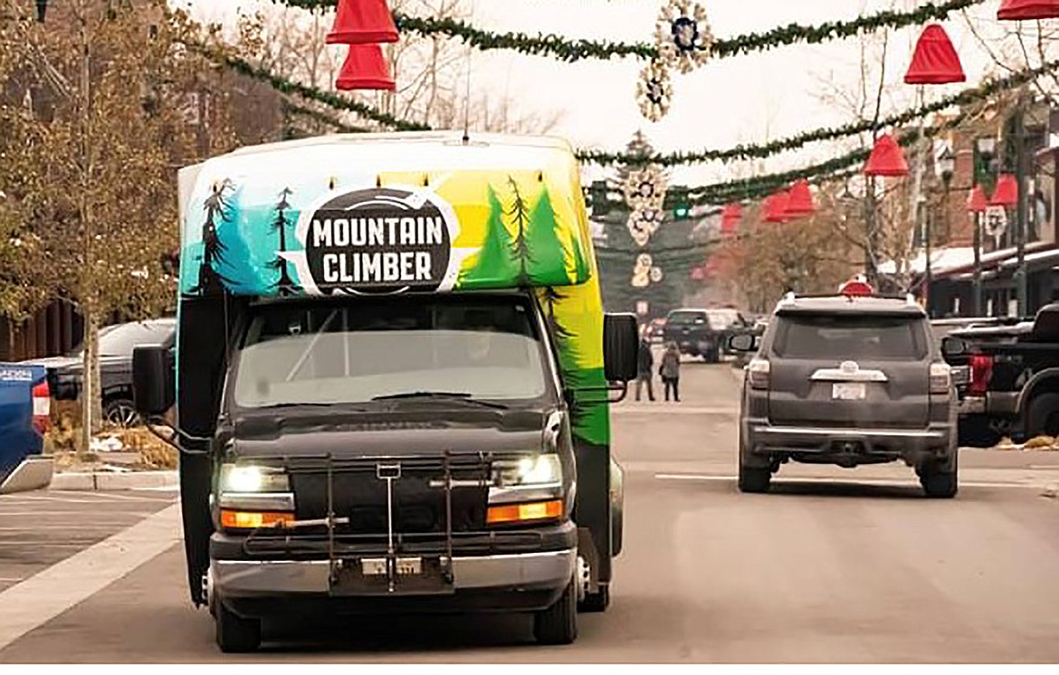
Mountain Climber
I spent five years in the Air Force working in emergency management and disaster relief, including in the command post during emergency operations. I have an associate degree in emergency management and disaster relief, and I’m currently pursuing a PhD in applied anthropology. I’m therefore looking at this Community Wildfire Protection Plan (CWPP) from both an emergency-management and applied-anthropology perspective.
Thank you for the work that went into this CWPP. I support its focus on evacuation planning, emergency access, road constraints, public notification, interagency coordination, and identifying where wildfire risk overlaps with limited access. Those strengths also reveal a significant readiness gap that deserves more attention: transportation capacity.
The CWPP does a good job identifying where evacuation could become difficult. It identifies one-way-in and one-way-out neighborhoods, limited road connectivity, bridge constraints, narrow and winding roads, and limited alternative routes. The Road Entrapment analysis is particularly important because it identifies roads exposed to modeled flame lengths of eight feet or more, where extreme fire behavior could make those roads vulnerable to entrapment. In emergency-management terms, these are potential choke points.
The plan also acknowledges that an evacuation order may be issued when wildfire conditions are expected to threaten evacuation routes within 8 to 12 hours, and that fire behavior can change quickly enough that there may not be time to move sequentially through every level of notification. Think of what's happening in WA right now.
So we need to ask a basic readiness question: How many people can Whitefish actually move to safety within that window if everyone is expected to use a private vehicle?
We already know what Highway 93 can look like during normal conditions. Now add an evacuation, visitors unfamiliar with the road network, workers away from home, people without private vehicles, households trying to travel together, people needing assistance, and emergency responders using the same transportation network. That is both a road problem and a transportation-capacity problem.
The CWPP’s Areas of Concern show where this matters most. AOC 6 around Reservoir Road and Kaeding Creek Road has limited connectivity and access constraints. AOC 7, North Whitefish, identifies constrained southbound egress around the Baker Avenue bridge and viaduct. AOC 8 combines dense timber fuels with winding roads and neighborhood connections to primary roads. Whitefish Hills in AOC 12 has continuous timber fuels, hilly terrain, long driveways, and dirt roads. AOC 13 around Beaver Lake and Lion Mountain similarly combines dense fuels, complex topography, scattered development, and long winding roads.
These are not only places where we should ask, “Can we make the road safer?” We should also ask, “How many people need to use this road, how will they get there, and what happens if they cannot all get through?”
The CWPP recommends improving roads, reducing roadside fuels, identifying evacuation corridors, mapping access constraints, establishing traffic control, and developing evacuation protocols. Those are necessary. But they largely address the infrastructure side of evacuation. They do not tell us how many people the system can actually move before a route becomes unsafe.
That is where I see a readiness gap.
The City should fund expanded year-round public transit and deliberately incorporate that existing network into its emergency-management system.
This is not about replacing evacuation routes with buses but adding redundancy. An evacuation plan is ultimately a plan for moving people, and people do not behave like dots on an evacuation map.
During an emergency, people make decisions with incomplete information. They look for family members, check on neighbors, return home, wait for someone who is still at work, or take a familiar route rather than an unfamiliar one. A seasonal worker may be across town without a vehicle. A parent may be trying to pick up a child. An older resident may need assistance. A visitor may not know where to go. Someone may have a vehicle that is unavailable, damaged, out of fuel, or being used by another household member. These are predictable features of emergency behavior, not edge cases.
We should therefore identify not only the roads likely to become constrained, but the people likely to be constrained by them. We should verify how many people have access to a vehicle, who may need assistance, where people are likely to be when an evacuation begins, and how many people the road network can realistically move.
A standing public transit network gives emergency management something extremely valuable: an existing capability.
Under normal conditions, it transports workers, older residents, students, people without cars, and visitors. During a wildfire, that same network can become part of the transportation component of incident response. But that capability needs to be established before the fire, not improvised during one.
The CWPP already uses a Ready, Set, Go framework. Transportation should be incorporated into it.
During Ready, establish standing routes, identify emergency pickup locations and evacuation centers, identify accessible vehicles and transportation resources, and establish who can activate the system and how transit coordinates with emergency management.
During Set, buses and drivers can be identified and positioned, emergency pickup locations activated, and people who are unlikely to evacuate independently moved toward evacuation centers while routes remain viable. Transit can coordinate with traffic control and emergency routes based on current fire conditions.
During Go, the system executes a plan that already exists rather than improvising one.
I am asking the City to add an explicit transportation component to the evacuation and emergency-management recommendations in this CWPP and fund expanded year-round public transit as part of that preparedness strategy.
The City should identify emergency transit pickup locations and incorporate them into evacuation maps and public education; establish primary and alternate transit evacuation routes using the CWPP’s existing road-entrapment, access-constraint, and AOC analyses; establish an emergency activation protocol between Mountain Climber, the City, emergency management, fire, law enforcement, and other response agencies; identify accessible transportation resources; and incorporate transit into wildfire tabletop exercises and evacuation drills.
Expanded year-round public transit is a practical readiness investment. It improves transportation every day while giving Whitefish and the surrounding region an additional evacuation asset when we need it most.
Isabella Brown, Whitefish, Forward Montana Flathead lead organizer