
Rains, cooler weather give Upper Smith crews a helping hand
Bonner County Daily Bee | UPDATED 2 months, 2 weeks AGO
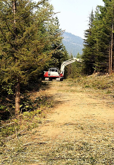
Recent rainfall has helped slow the Upper Smith Fire in Boundary County, increasing containment to 35% and allowing evacuation status in nearby areas to be lowered from Set to Ready.
Photo courtesy USDA FOREST SERVICE
BONNERS FERRY — Recent rains in Boundary County have dampened growth on the Upper Smith Fire while boosting containment of the five-week-old fire in northern Boundary County.
With the improved conditions, which also include continued progress on strengthening control lines, Boundary County Sheriff Travis Stolley downgraded the evacuation status near the fire from "Set" to "Ready."
Under "Ready" status, residents are advised to have a plan to evacuate if necessary; under "Set" status, residents are advised to begin putting their plan into place. Under "Go" status, residents are advised to leave immediately due to an imminent threat.
"Residents in the Parker Creek and Copeland zones should remain prepared," Stolley said. "Keep your go-bags ready, vehicles fueled, important documents accessible and family/pets accounted for."
A Thursday reconnaissance flight found most fire activity was centered mid-slope on the north aspect of Long Canyon, with isolated activity on the south aspect. However, the fire has not crossed south of Parker Ridge or Trail 221.
Some crews are continuing work on contingency lines, while others are strengthening the Smith Creek containment line and mopping up hotspots. Along Westside Road, crews are continuing structure protection efforts.
Crews are working to reopen an old road system south of the fire, constructed as part of the Kootenai Complex, to serve as a contingency line, Northern Rockies Blue Team officials said. Also, aviation resources will be used as needed to limit fire spread westward in Long Canyon and south toward Parker Ridge.
Located 20 miles northwest of Bonners Ferry and 6 miles west of Porthill, the fire has burned 3,697 acres and is 35% contained.
There are 186 personnel assigned to the fire, including four hand crews, three helicopters, eight engines, six water tenders, two ambulances and assorted heavy equipment.
Located 2 miles east of Porcupine Lake in Bonner County's Porcupine Creek drainage, the Porcupine Fire has burned 110 acres. The fire is 0% contained.
Air support continues to be key in fighting the fire, which is located in an area with steep slopes, cliffs and rocks, preventing direct fireline construction for much of the fire.
Suppression efforts are focused on keeping the fire from crossing over the ridge and establishing on the southeast face, which would increase the threat to nearby homes, property and other at-risk values, Idaho Panhandle National Forest officials said on InciWeb, an interagency incident information management site.
All remaining evacuation levels on the Autumn Lane, Fairview and Old Trails fires have been lifted.
Fire danger remains rated as extreme in the region, meaning that fires of all types start quickly and burn intensely, according to local U.S. Forest Service officials.
Stage 2 fire restrictions are in effect in Bonner and Boundary counties, while Stage 1 fire restrictions are in effect in Kootenai, Shoshone and Benewah counties.
Under Stage 1 fire restrictions, campfires and stove use are prohibited except at designated recreation sites, on private property or in approved fire structures. Smoking is limited to enclosed vehicles, buildings or cleared areas free of flammable materials.
Stage 2 fire restrictions prohibit fires and campfires and smoking except within an enclosed vehicle or building, or a designated recreation area that is at least 3 feet in diameter and barren or cleared of flammable materials. In addition, "Hoot Owl" restrictions limit chainsaw and machinery operation from 1 p.m. to 1 a.m.
For more information on fire restrictions, go to bit.ly/45a7eIT.
Information: InciWeb.wildfire.gov