
THE DIRT: December flooding on the Coeur d’Alene River — An unusual early-season event
Coeur d'Alene Press | UPDATED 7 months, 1 week AGO
Courtesy photo
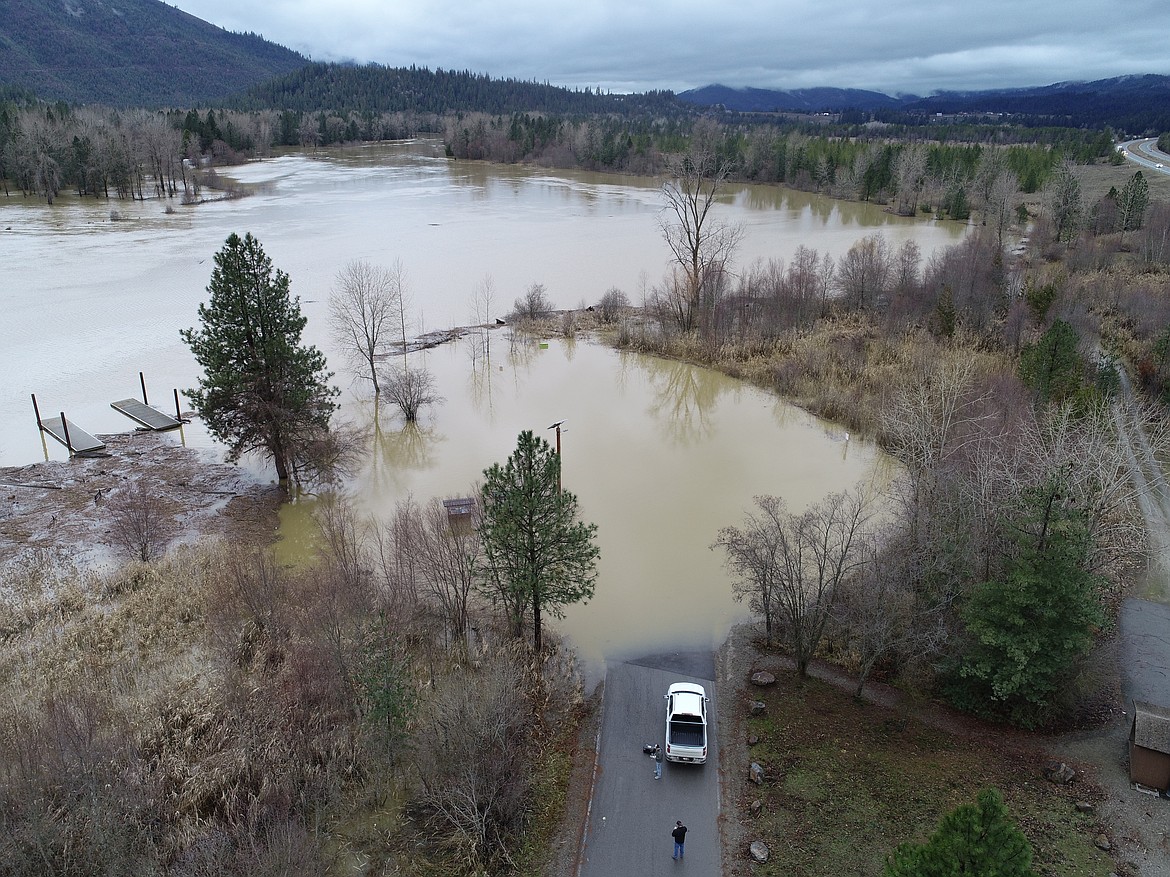
The flood event that struck the Coeur d’Alene River Basin around Dec. 11, 2025, was unusual, not because flooding itself is rare in North Idaho, but because of when and how it occurred.
December 2025 brought historically high air temperatures and was the second-wettest December on record at most SNOTEL sites in the Basin. A SNOTEL site is an automated, remote station that measures snowpack, precipitation, and temperature to track water-supply conditions, especially in mountain watersheds. While rain-on-snow events are fairly common in the Coeur d’Alene River watershed, this one stood out due to its sheer magnitude and geographic reach. Rain fell across nearly all elevation bands, including the highest elevations that typically remain cold enough to store snow well into winter. Under normal conditions, rain at lower elevations might trigger some snowmelt, but this event caused widespread melt across the Basin.
In terms of historical context, the December 2025 flood ranked 28th in daily median stream volume for the Coeur d’Alene River. While it did not exceed the largest floods on record — such as the historic January 1974 flood or the February 1996 event — it was notable for occurring much earlier than typical high-flow events. The largest floods in the Basin have historically taken place in January or February, with most high flows occurring during the April-May runoff season. December floods exceeding the median streamflow are relatively rare, making this event an outlier.
Several factors combined to push water into rivers and streams rapidly. Warmer-than-normal conditions in November, followed by a record-warm December, produced an unusually dense snowpack across the Basin. Dense, warm snow is less capable of absorbing rain than colder, lighter snow. Near-normal precipitation in October and early December, rain at lower elevations, also left soils saturated. When soil is already wet, it cannot absorb much additional water, thereby accelerating runoff into creeks, rivers, and lakes. Together, above-normal temperatures, dense snowpack, and saturated soils created what hydrologists describe as a “perfect storm” for flooding.
Tributaries played a role as well. While limited snowpack monitoring exists in the headwaters of Prichard Creek and Beaver Creek, it is reasonable to assume they experienced similar melt conditions. The North Fork of the Coeur d’Alene River near Prichard reached record-high flows in December, underscoring the widespread nature of the event.
Looking ahead, climate trends suggest December-season flooding could become more common. Although overall snowpack in the western United States is declining, warmer temperatures mean that the snow that does accumulate is often denser and more prone to rapid melt during rain events. Many studies indicate an increasing likelihood of rain-on-snow events — conditions that increase flood risk even outside the traditional runoff season.
• • •
The Dirt is a series of informative articles focused on all aspects of cleanup efforts associated with the Bunker Hill Superfund Site. Our goal is to promote community awareness of contamination issues, to provide tools to protect public health and to keep the community informed about current and future cleanup projects. The Dirt is a group of committed, local experts from multiple agencies, including the Basin Environmental Improvement Project Commission, the Panhandle Health District, Shoshone County, the Silver Valley Economic Development Corporation and the Idaho Department of Environmental Quality.