
Climbing Mount Penrose, for the history of it
RIVER BLAZEJEWSKI | Hungry Horse News | UPDATED 3 months, 3 weeks AGO
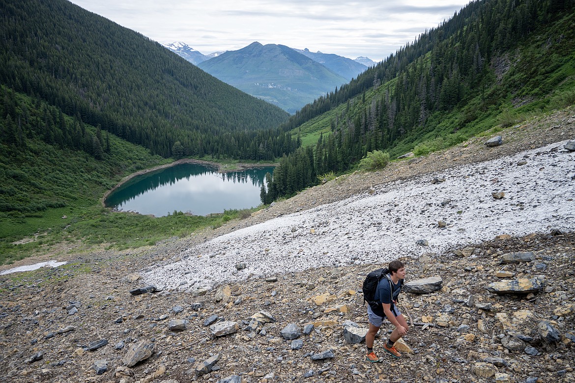
Brock Swope slogs up Mount Penrose.
There’s some mountains you climb for bragging rights, name, or prominence. Others you climb for the history.
In 1907, Philadelphia surgeon and Boone and Crockett Club member Charles Bingham Penrose was on a hunt in a remote basin at the base of modern-day Mount Penrose. It was here that he shot a rare albino cub grizzly. Unfortunately for him, moments later the cub’s mother, “The Great Bear,” attacked him, leaving him with life-threatening injuries.
The three-man party he was with recognized they needed to get him to the Great Northern Railway as soon as possible to transport him back to a hospital. Instead of heading out via the rugged terrain they entered, they opted to take him out along a creek which would come to be known as Rescue Creek, rightfully so.
Today, Great Bear Mountain, the Great Bear Wilderness, Mount Penrose, and Rescue Creek all bear their names thanks to this expedition.
Penrose stands majestically around 3,000 feet above Skiumah Lake, which sits in arguably the prettiest basin in the Great Bear Wilderness.
Brock Swope and I had been talking about Penrose for years. People tend to overlook the mountain, yet its pyramidal structure makes it quite prominent to its neighboring Essex peaks.
We set off down the Skiumah Lake trailhead at 8:30 a.m., with our summit window of 12:15 in mind. Otherwise, we’d turn around. It was scheduled to rain at noon, and we didn’t want to be stuck up at the summit in a monsoon.
It takes a certain person to appreciate the Great Bear. Devil’s club with leaves as big as dinner plates claw eagerly at hikers’ legs, and somehow it’s always foggy.
Yet, Skiumah Lake is a hike I’d recommend to anyone. It’s already been cleared this year.
Upon reaching the lake, we took a moment to breathe it all in. Skiumah was perfectly calm, and the morning had started relatively clear.
We decided to go around the right side of the lake, as it’s easier to step over driftwood than circumnavigate trees. The head of the lake really opens up into an alpine meadow with thimbleberry, paintbrush, arnica, and rocky mountain aster. Following an unnamed creek allowed us to dodge alder until it opened up into a continuous alpine slope. From there, it’s a semi-technical “slog.”
We alternated between scree and snowfields, with the last 500 feet to the ridge requiring crampons and ice axes. Luckily, the south-facing ridge was clear of snow, which made the summit push relatively easy.
We topped out at noon, rewarded with up close views of Great Northern Mountain, the Ousel drainage, Hungry Horse Reservoir, and Glacier National Park. Sure enough, five minutes later it started to downpour.
At the end of the day, it took us 7 miles with around 5,000 feet of climbing.
Way to go, Charles. These mountains aren’t getting any easier.