
Evacuations likely on Upper Smith Fire
CAROLINE LOBSINGER | Hagadone News Network | UPDATED 2 months, 4 weeks AGO
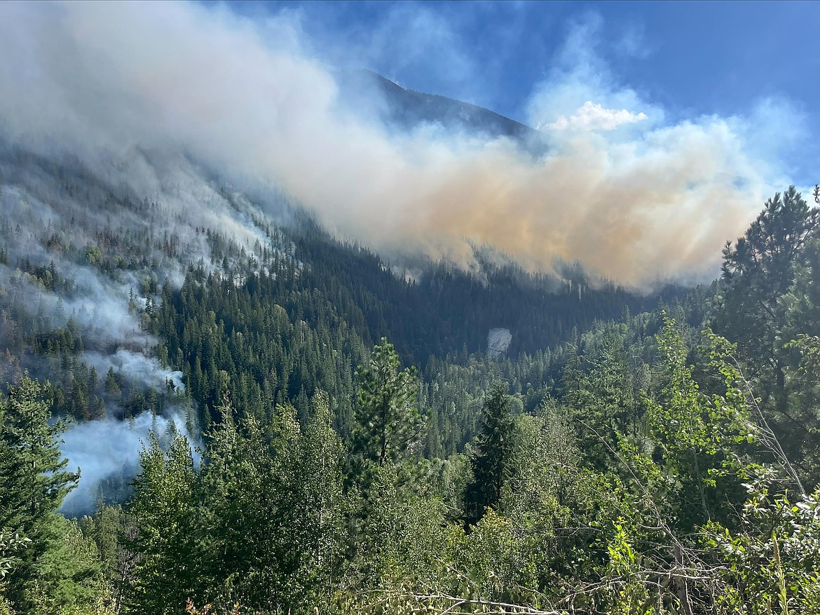
A view of the Upper Smith Fire from the air on Sunday, July 26.
Photo courtesy USDA FOREST SERVICE
I grew up in the Tri-Cities, Wash., and have always loved to write. I attended the University of Washington, where I earned a double major in journalism and political science, with an area of emphasis in history. I am the fifth out of six kids — don't believe any of the stories that my siblings tell. To be able to tell others stories and take photos for a living is a dream come true — and I considered myself blessed to be a community journalist. When I am not working, I enjoy spending time with family and friends, hiking and spending time outdoors, genealogy, reading, and watching the UW Huskies and the Seattle Seahawks. I am a servant to my cat, Frankie, who yes, will eat anything and everything in sight … even wedding cookies. | July 28, 2026 1:07 AM
BONNERS FERRY — It's a matter of when some residents near the Upper Smith Fire will be asked to evacuate, not if, Northern Rockies Team 1 officials said at a community meeting Monday.
"We do anticipate, just to be brutally honest with you, in the next couple days, me coming out with some sort of recommendation for a Go evacuation," Boundary County Sheriff Travis Stolley told the 30 or so area residents who attended the fire information meeting.
What that means is looking at a number of factors, ranging from proximity of the fire to critical structures and the safety of residents, the public and firefighters, Stolley said.
Under "Ready" status, residents are advised to have a plan to evacuate if necessary; under "Set" status, residents are advised to begin putting their plan into place. Under "Go" status, residents are advised to leave due to an imminent threat.
"So, these guys, as they're kind of describing this, this what their action plan is taking this fire over here and then, you know, making it go a certain direction," the sheriff said. "Well, that's all fine and dandy, right? If it works. But what if it doesn't, right? And that's where my concerns are. And I'm going to err on the side of caution."
While he isn't going to come to their homes and force them to leave, Stolley said he hopes residents will leave to allow crews to focus on fighting the fire.
"I'm just asking for your consideration when we hit that Go status," he added. "I'm taking all of these things into consideration, and you need to obviously make the decision what you think is best for you. But if that fire comes and we're having to deal with that extra piece, you know we really ask that you take that recommendation seriously."
There are a couple of management action points and several evacuation zones, Stolley said. A manned checkpoint is being set up in the Westside Road area with evacuation zones near Westside Road and Parker Road, both of which are currently at "Set."
Among the discussion points are fire behavior, the speed of the fire's growth and the sheriff's office's ability to contact the public.
"Right now, because we've had so much time to prep the fire structures, and the structure protection, all that plays a role in what we're going to do or not," Stolley said.
The fire, which was sparked by lightning on July 8, has burned 1,518 acres, some of which is the result of firing operations. In firing operations, crews use both ground and aerial efforts to set small fires to guide a fire to a set point and away from critical assets, such as homes and agricultural fields.
Located 6 miles west of Porthill and 20 miles northwest of Bonners Ferry, the fire is 15% contained. There are 422 personnel assigned to the fire, including seven helicopters, six hand crews, 12 engines and 12 water tenders, as well as assorted heavy equipment.
Fire crews are working to get the fire down to the bottom near Smith Creek and hold it for a few days to ensure there are no spot fires. Crews will then work back to the anchor point near a rock outcropping as a direct "Option A," Operations Section Chief Scott Schrenk said.
If that plan doesn't work, crews are working on a fallback option where firefighters tuck into Long Canyon. Another option would be to utilize the Long Canyon Fire burn scar to keep the fire away from the valleys and other at-risk areas.
Schrenk estimated the work could take crews two or three days.
If the fire crosses a set point, it will likely trigger implementation of "Go" status. The area was recently upgraded to "Ready," and crews are preparing to upgrade to "Go" status in the event plans don't unfold the way Northern Rockies Team 1 officials anticipate.
Firefighters are working to strengthen both primary and indirect control lines while helicopter and fixed-wing aircraft remain engaged in support of firing operations. Firing operations focused on guiding the fire toward Smith Creek, Northern Rockies Team 1 officials said.
Helicopter water drops are being used to slow the fire's spread on the northern and eastern flanks, while retardant drops are reinforcing the southern and southeastern ridges to help check fire spread. In addition, crews are continuing protection and defensible space improvements where needed.
Monday, firefighters worked to boost key sections of indirect fireline along Upper Smith's east side using a combination of heavy equipment, chippers and hand crews.
"These firelines are designed to provide firefighters with multiple tactical options and support long-term containment efforts," Northern Rockies officials said in a press release. "Firing operations to remove fuels south of Smith Creek will continue today as conditions allow. Smoke will be visible across the fire area."
Temporary flight restrictions are in effect over both fires to ensure the safety of suppression aircraft. Both personal aircraft and drones are included in the TFRs. Northern Rockies Team 1 officials said there have been several incidents of private drones flying in the TFR zone, which prevents the team's helicopters and planes from taking off.
Anyone caught flying a drone or a private aircraft can face up to $100,000 in fines and up to a year in federal prison.
Both Smith Creek Road and Long Canyon Trail have been closed to public travel. Closures in the Westside and Kerr Lake Road areas, as well as a closure of Riverside Street, are connected to county projects. The Parker Ridge Trail is in the process of being closed due to its access to the bridge construction and its proximity to road prep work related to the Upper Smith Fire.
While both the Copeland and Porthill boat launches are open, residents are advised to be on the watch for aerial resources that may need to access the Kootenai River for water drops if water is needed to cool the fire.
Information: InciWeb.wildfire.gov
ARTICLES BY CAROLINE LOBSINGER

Wellness fair puts focus on health
The Wellness & Connection Fair is bringing together local health and wellness professionals together in Sandpoint for a day of presentations, activities and community resources.

BCSD pays share of ISBT shortfall
District opts to make lump sum payment
Boundary County School District paid $217,000 to cover its share of the Idaho School Benefit Trust's $13 million shortfall.

Deadline extended for 'Valor' stories
The Valor publication is gathering photos, military service details and personal stories from Boundary County veterans and military families. Featured profiles highlight local service members' contributions, achievements and sacrifices across generations.