
Forest project near Trout Creek approved
Valley Press-Mineral Independent | UPDATED 1 day, 5 hours AGO
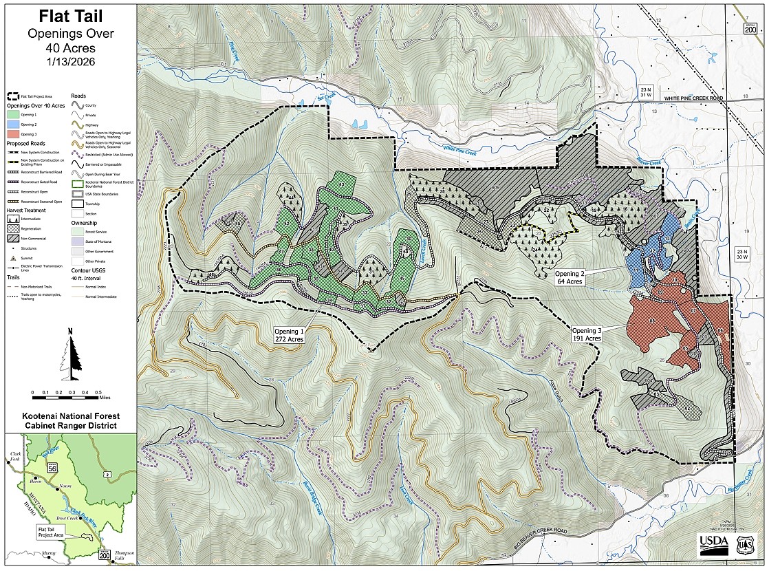
Kootenai Forest officials last week approved the Flat Tail forest project southeast of Trout Creek after determining the area was susceptible to forest fire and disease.
The project area is on the Cabinet Ranger District in Sanders County between Big Beaver Creek Road and White Pine Creek Road and includes Larch Point, Set Creek, Larch Creek and Basin Creek.
Work includes 1,451 acres of vegetation and fuels management. Commercial harvest encompasses about 903 acres, with non-commercial and underburn taking place on 548 acres. Twenty-three proposed harvest units would create three openings over 40 acres in size.
Roughly 1.5 miles of new roads are planned, with road reconstruction and maintenenace on 18 miles of Forest Service roads.
Work is expected to begin this fall.
The project was developed under the federal Forest Health and Fuels Emergency Situation Determination program that streamlines the approval process.
In approving the project, the Forest Service determined the work was limited in scope would ultimately improve forest health and wildlife habitat by reducing the risk of fire and disease.
"The proposed action would have long-term beneficial impacts by increasing the ability to withstand disturbances of the natural environment and provide safer fire management opportunities," the finding states. "Reducing tree density provides growing space for remnant, healthy trees and reduces the ability for a fire to spread from tree to tree, or from the surface to the canopy. Increasing species diversity and selecting species that are not adequate hosts for existing insects and disease pathogens reduces tree mortality."
A 14‑day comment period held from Aug. 21 through Sept. 4 produced 30 letters in response.
“Based on the comments received, the EA and vegetation analysis were updated to include more information about snags across the project area and the Forest,” the finding states. “The hydrology analysis and EA were also revised to clarify information in response to a public comment."