
Labor Day: Record heat followed by wind, snow
MATT BALDWIN | Hagadone News Network | UPDATED 6 years, 1 month AGO
Hagadone Media Montana REGIONAL MANAGING EDITOR Matt Baldwin is the regional editor for Hagadone Media Montana, where he helps guide coverage across eight newspapers throughout Northwest Montana. Under his leadership, the Daily Inter Lake received the Montana Newspaper Association’s Sam Gilluly Best Daily Newspaper in Montana Award and the General Excellence Award in 2024 and 2025. A graduate of the University of Montana School of Journalism, Baldwin has called Montana home for nearly 30 years. He and his wife, Sadie, have three daughters. He can be reached at 406‑758‑4447 or [email protected]. IMPACT: Baldwin’s work helps ensure Northwest Montana residents stay connected to their communities and informed about the issues that shape their everyday lives. | September 4, 2020 3:00 AM
Northwest Montana is poised for a wild week of extreme weather. Near-record heat and dangerously dry conditions over the weekend will give way to raw, winter-like weather beginning Labor Day.
According to the National Weather Service in Missoula, hot and dry conditions will persist through Saturday across the Northern Rockies. Highs are expected to climb into the 90s.
A fire weather watch is in place for parts of southwest Montana due to the mix of low humidity, hot temperatures and potential wind.
“That being said, everyone should be wary of creating a spark that could result in a new fire just about anywhere in western Montana or north central Idaho, given how hot and dry conditions will be,” the Weather Service warned in its forecast discussion Friday.
A slight cool down begins Sunday before an unseasonably cold and wet weather system moves into the region.
Labor Day will be “tumultuous” with strong winds out of the east-northeast with gusts up to 50 mph possible in the Flathead Valley.
Significant wave action on Flathead Lake is likely, with potential damage to docks, boats and property along the west and southern shores.
Meanwhile, snow levels could dip to elevations as low as 5,000 feet, “and will create raw, cold, and wholly unpleasant backcountry conditions,” the Weather Service warned.
Up to 6 inches of snow could accumulate at Logan Pass in Glacier National Park. Wind chills will be in the low 20s above 6,000 feet.
More seasonal temperatures in the 70s and 80s should return by mid week.
ARTICLES BY MATT BALDWIN

Region's residents flock to Kalispell for Trump appearance
Slyvia Timboe, 76, said it was the chance of a lifetime to see President Donald Trump speak in person. It took her just 20 minutes to drive to Majestic Valley Arena in Kalispell on Wednesday, where the president was scheduled to speak as part of a country-wide tour to stump for Republican candidates ahead of the midterm election.

Suspect arrested after Whitefish standoff involving SWAT, K-9
A suspect was arrested in Whitefish on Saturday evening following a standoff involving multiple law enforcement agencies and a K-9 unit.
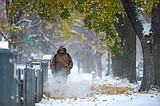
Western Montana on track for season's first winter storm
It's time to pull out the ice scraper and shovel and put away the garden hose.