
Blizzard forecast prompts school closures on Thursday
MATT BALDWIN | Hagadone News Network | UPDATED 7 months, 2 weeks AGO
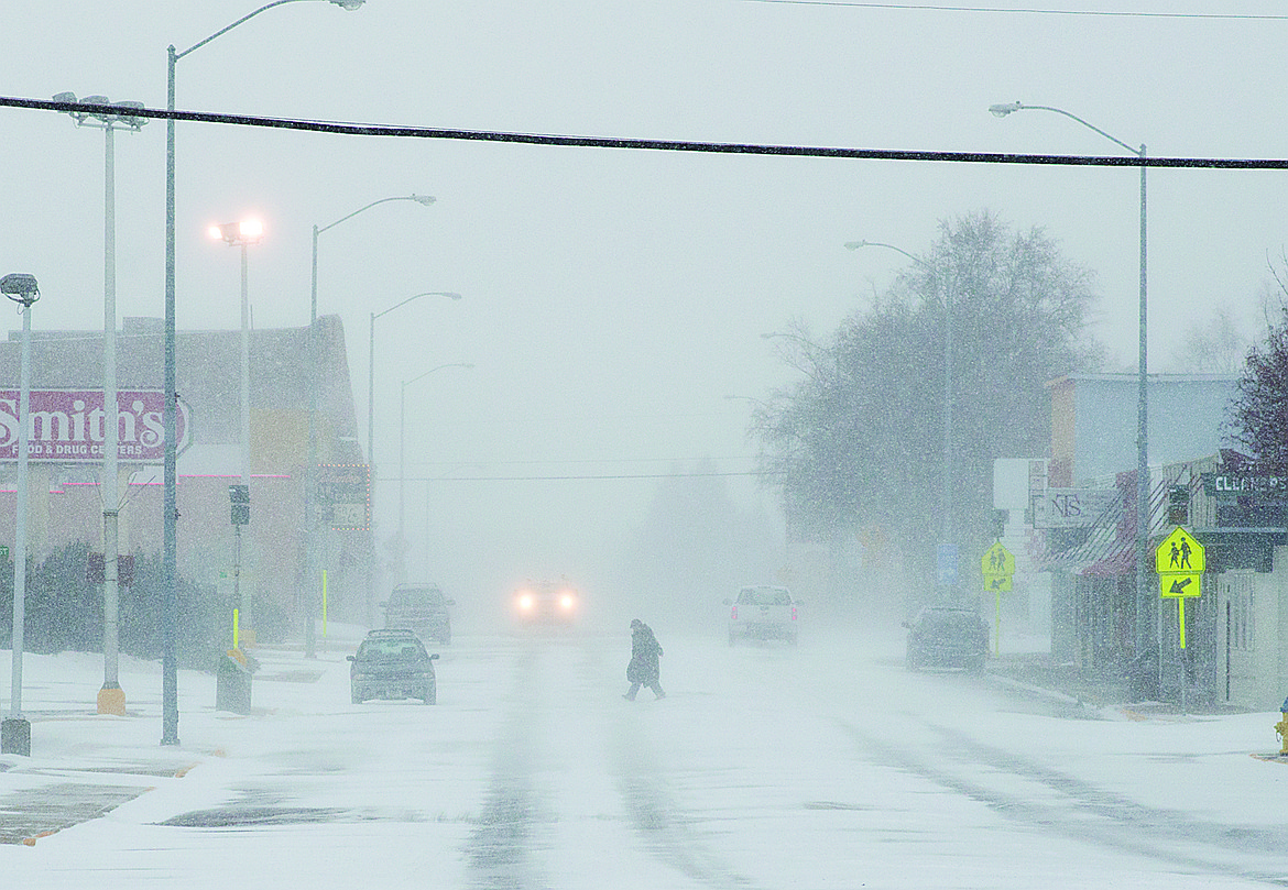
A woman crosses Nucleus Avenue in Columbia Falls during a blizzard in this file photo.
Hagadone Media Montana REGIONAL MANAGING EDITOR Matt Baldwin is the regional editor for Hagadone Media Montana, where he helps guide coverage across eight newspapers throughout Northwest Montana. Under his leadership, the Daily Inter Lake received the Montana Newspaper Association’s Sam Gilluly Best Daily Newspaper in Montana Award and the General Excellence Award in 2024 and 2025. A graduate of the University of Montana School of Journalism, Baldwin has called Montana home for nearly 30 years. He and his wife, Sadie, have three daughters. He can be reached at 406‑758‑4447 or [email protected]. IMPACT: Baldwin’s work helps ensure Northwest Montana residents stay connected to their communities and informed about the issues that shape their everyday lives. | March 11, 2026 2:00 PM
Schools across the Flathead Valley preemptively canceled classes for Thursday in anticipation of a major winter storm expected to hit the region overnight Wednesday.
Flathead County Sheriff Brian Heino met with school district superintendents Wednesday and advised all Flathead County schools to close out of an abundance of caution. After-school activities were also canceled at many districts.
Blizzard and high wind warnings were issued for the valley, with gusts up to 70 mph possible through Thursday. Damaging winds were expected to blow down trees and power lines, causing widespread outages.
Flathead Electric Cooperative advised people to prepare by charging devices and gathering emergency supplies and making sure flashlights have fresh batteries.
The greatest impacts will focus across Lincoln and Flathead counties and the high terrain, the National Weather Service in Missoula warned.
Along with wind, the prolonged atmospheric river event was on track to dump feet of snow on western Montana mountains.
“The worst conditions and impacts will be felt across the Glacier Park region, specifically on U.S. 2 east of West Glacier to Marias Pass and in the higher terrain, where several hours of whiteout conditions are expected,” the Weather Service warned.
On Marias Pass, snow rates of an inch an hour, coupled with 50 mph winds, are probable as the storm hits.
The atmospheric river will continue to bring heavy mountain snow through Saturday. Some areas could be buried in up to 5 feet of powder, with the bull’s-eye on the Montana-Idaho border and the Glacier Park areas.
Valley snow amounts vary, with anywhere from 1 to 10 inches possible.
ARTICLES BY MATT BALDWIN

Region's residents flock to Kalispell for Trump appearance
Slyvia Timboe, 76, said it was the chance of a lifetime to see President Donald Trump speak in person. It took her just 20 minutes to drive to Majestic Valley Arena in Kalispell on Wednesday, where the president was scheduled to speak as part of a country-wide tour to stump for Republican candidates ahead of the midterm election.

Suspect arrested after Whitefish standoff involving SWAT, K-9
A suspect was arrested in Whitefish on Saturday evening following a standoff involving multiple law enforcement agencies and a K-9 unit.
Western Montana on track for season's first winter storm
It's time to pull out the ice scraper and shovel and put away the garden hose.